

Details
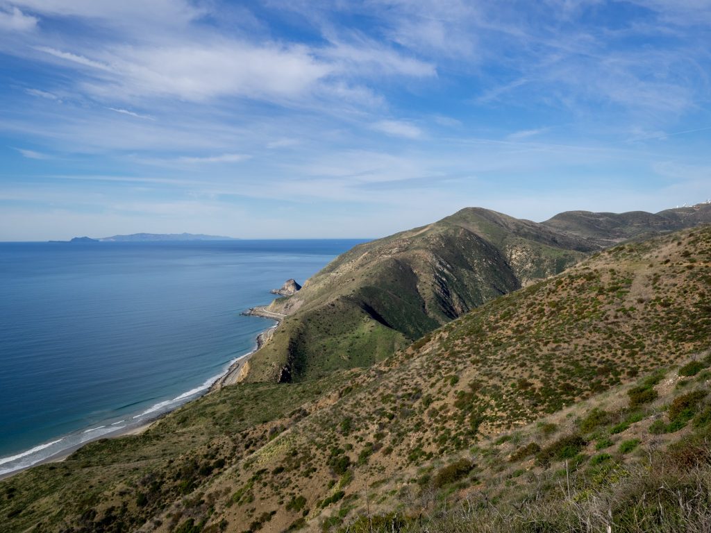
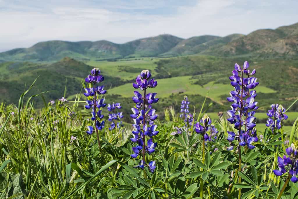
Join us and the small animals and birds of La Jolla Canyon on this loop hike with panoramic views of coastline and The Channel Islands. Flower blooms in the spring are phenomenal. One of the the main attractions are large swaths of native California grassland — some of the last remaining unspoiled areas in the state.
[asa2_collection tpl=”Flat_box_horizontal” orderby=”rand” show_features=”no” show_description=”no” limit=”1″]6[/asa2_collection]
Because of the continued closure of the canyon trail up to the waterfall we are going to do this in a special way. We’ll meet on PCH at the entrance to the canyon and walk 2 miles down the ocean side of scenic PCH to the Chumash Trail. Several years ago PCH flooded out and broke up and had to be realigned — we’ll walk along the old broken PCH.
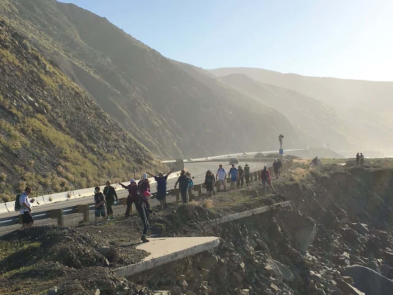
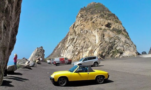
Along the way we’ll have the opportunity to come face to face with Mugu Rock! You’ve seen it in the distance, now you will be able to touch it.
Consider the walk along PCH a warmup to the strenuous Chumash Trail. The Chumash trail is an ancient trail which leads from the Pacific Ocean to La Jolla Valley. It was used by the Chumash 7000 years ago, and believed to be the oldest trail still in continuous use in the Santa Monica Mountains.
This trail is very strenuous with almost 1,000 feet gain in only 0.6 miles. But the views from the top are spectacular
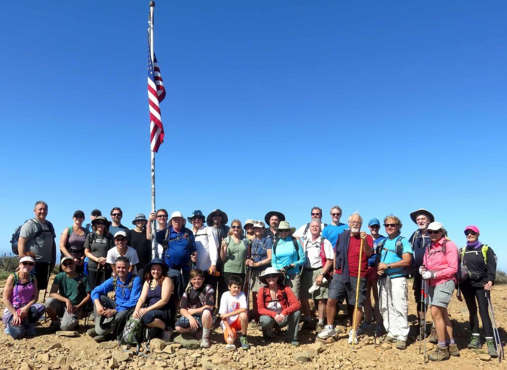
After we climb the Chumsh Trail we’ll swing around the Pt Mugu Peak Trail and bag Mugu Peak. We’ll take a group photo at the flag pole. Every year on 9/11, since 2002, chief selects from the Naval Base Ventura County replace the flag on Mugu Peak. The previous flag is retired in a ceremony on the base.
Here we are a couple years back
After descending the peak we’ll head into the grasslands of La Jolla Valley
We’ll be taking our break at the hike-in campsite. There is a fancy outhouse there. One of the highlights along the way is this pond. Will there be water this week? Naw.

After our lunch break we’ll hike along the ridge separating Sycamore Canyon and La Jolla Canyon. We’ll return to our cars via the Ray Miller Trail – the western terminus of the Backbone Trail
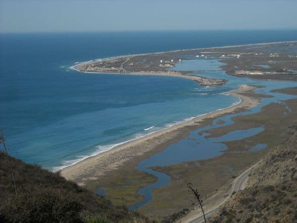
Here us the view from the Ray Miller Trail

[av_notification title=’Hike Rating’ icon_select=’yes’ icon=’ue8c5′ font=’entypo-fontello’ color=’orange’ border=’solid’ custom_bg=’#444444′ custom_font=’#ffffff’ size=’large’ close_btn=” cookie_lifetime=’60’ av_uid=’av-kdw5i1′ custom_class=” admin_preview_bg=”]
Hike is 12 miles with about 2,200 ft total ascent and is rated DIFFICULT due to terrain and distance. See the Hike Ratings Guide
[/av_notification]
Bring at least 2qt water, snacks
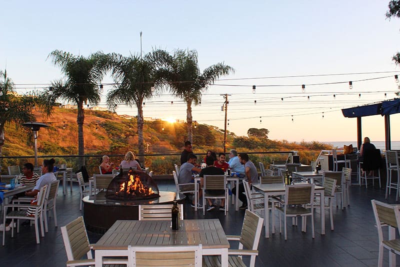
Post Hike Lunch
Spruzzo Restaurant and Bar
29575 Pacific Coast Hwy (turn left on Busch Dr.)
Malibu, CA 90265
Tel: (310) 457-8282
Directions to Trailhead
There is free parking on PCH near park entrance. If you have to park inside there is an iron ranger that accepts credit cards, or maybe even a human at the gate.
From Los Angeles, after a long and relaxing drive down the Pacific Coast Highway (22 miles past Malibu Canyon), you’ll enter Ventura County and pass the so-called “Great Sand Dune.” Across the street from Thornhill Broome Beach is the entrance to La Jolla Canyon. It is very clearly marked. Park on PCH on either side of entrance.
From Ventura: Entrance is a couple miles after Las Posas. Park on land side of PCH on either side of entrance.
Meet on PCH at entrance to park


