

The Stats
Not for beginners
Distance: 10 miles>
Elevation Gain: While mostly downhill, there will still be at least 1500 ft. of uphill.
Rating: Moderate 7/10, off trail, bushwhacking, poodle dog bush, poison oak, creek walking, etc…
Duration: 5-7 hours
NO SWEEPER!! wait-listed
Rain, snow – cancels the hike
The Plan
We will meet at the Switzer Falls lower parking lot, consolidate vehicles and then head 8:30 am sharp over to Mt.Wilson Road which will get us to the Eaton Saddle. From the Eaton Saddle we’ll hike to the Tom Sloan Saddle with a couple peaks we could check out including Mt. Lowe along the way. Then from the saddle we can head back to our cars at Switzers via Bear Canyon.
Carpooling
See below for details

The Story
By the time Thaddeus Sabieski Constantine Lowe retired to Southern California in the late 1880’s he had achieved more than most. The New Hampshire native and father of ten children had built the largest balloon ever known for use in an attempt to cross the Atlantic Ocean and had served his country as the founder and Chief Aeronaut of the Balloon Corps during the Civil War. Lowe designed and patented, among dozens of other things, a portable hydrogen gas generator, an altimeter for use without a horizon, a system of aerial signal flags for directing artillery fire on targets not seen by the ground crew, an artificial ice and refrigeration apparatus, founded a gas works in Pennsylvania for the illumination and heating of both commercial and residential structures, and began dabbling in the banking industry.

Before heading down Bear Canyon we’ll take a snack break at the surprisingly remote, surprisingly large and well-maintained Bear Canyon Campground. The campground has lots of cleared space, plenty of metal fire rings, picnic tables, and even some metal stoves. Although the camp felt pretty out-in-the-middle-of-nowhere, it’s really only a bit more than three miles in from Switzer’s and just a little farther from the other side of the mountains in Altadena. From here, Bear Canyon offers a good chance for solitude, at least until we approach the Switzers area. There’s also some top-notch swimming holes down here. Nothing has the simultaneous waking-up and calming-down effect like a good splash in ice-cold mountain water.

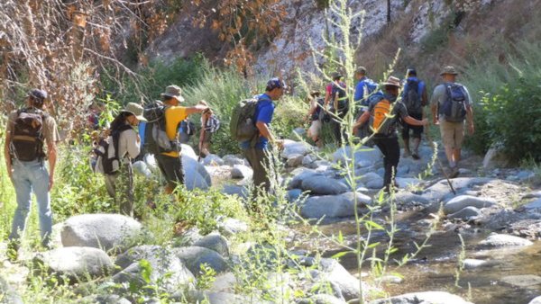
Switzer is a relatively easy hike into one of the loveliest sections of the San Gabriel mountains. The hike meanders back and across the stream running down the spectacular Arroyo Seco Canyon. The stream is lined with oaks and alder, with the water cascading over granite into mirror-like pools. The hike travels high above the 50 foot high Switzer falls, then drops back to the stream, where hikers can double back to stand at the base of the falls. The trail is good, but there are some steep drop offs in a couple spots. It is well shaded.

Directions: From the 210 Freeway, exit at Angeles Crest Hwy (SR 2) and go north. At 9.5 miles, you will come to the Clear Creek Information Station and the junction with Angeles Forest Highway. Continue straight on SR 2 about ¼ mile and you will see the Switzer’s Picnic Area sign and a large entrance gate on your right. Turn right and drive go past the gate,the road will go downhill 0.6 miles to the large paved parking area next to the creek.

Carpooling/Caravaning:While I don’t recommend arriving in full cars due to the car shuttle, solo drivers can consolidate at an area many hikers in this location use just north of the 210 on the 2 fwy. On Angeles Crest Hwy turn right on the second street north of the 210, Milmada Drive and then take an immediate left on the street that parallels the Angeles Crest. Plan to leave this location at 7:50am
These locations do require a National Forest Adventure Pass for parked vehicles. These passes can be purchased at most ranger stations (if open) in the area of our hike, most sporting goods, convenience stores and gas stations. The cost is $5/day or $30/yr. When buying an annual pass for $30 you can also buy an additional annual pass for $5. Splitting this fee with someone is the most economical way to get the passes. A National Parks Pass can also be used for parking as well and should have come with a rear view mirror hanger.
PLEASE – Know your limits and abilities. Bring and drink plenty of liquids when hiking. Check weather conditions and dress accordingly and be aware of your surroundings at all times. Watching out for snakes, ticks, uneven footing, spectacular views, beautiful fauna all while carrying on a conversation with awesome (usually) fellow hikers can be extremely hazardous, rewarding and fun. POODLE DOG ALERT: This area will have the dreaded poodle dog bush which to some can have an effect worse than poison oak. Once identified it should be easily avoidable.
VHC HIKE RATING SCALE
Rating a hike is subjective, meaning the difficulty of a hike will be in direct relation to how often you hike and the type of hike you prefer. Keep in mind that any hike can have the following: un-even hiking surfaces, various obstructions, water and/or water crossings or bouldering and/or rock hopping. A great hike will have all of these!
1 – A long walk
2 – 4 mile hike w/little elevation gain
3 – 5 mile hike w/up to1000 ft. elevation gain
4 – 5+ mile hike w/up to1500 ft. elevation gain (heart rate increases at times)
5 – 7+ mile hike w/over 1500 ft. elevation gain (heart rate increasing even more at times)
6 – 7+ mile hike w/over 2000 ft. elevation gain (at times you might be trying to remember how to perform CPR)
7 – 5+ mile hike w/over 2000 ft. elevation gain (at times you might be muttering expletives to yourself)
8 – 10+ mile hike w/over 3500 ft. elevation gain (at times you might be angry with the hike leader)
9 – 10+ mile hike w/over 5000 ft. elevation gain (at times you might be thinking of reporting the hike leader to the authorities)
10 – Use your imagination
Class 3 Scrambling: Scrambling or un-roped climbing. You must use your hands at times to hold the terrain or find your route. This may be caused by a combination of boulders, steepness and extreme terrain. Some Class 3 routes have ropes in place for assistance.
DISCLAIMER / RELEASE OF LIABILITY
IMPORTANT, PLEASE READ BELOW IN ITS ENTIRETY:
I am a volunteer (i.e. not liable for the group). Safety is a priority for everyone in the group. Think of this as hiking with a group of friends.
Outdoor sports and other events we plan can be inherently dangerous and accidents may happen. By participating in any posted event, you’re taking responsibility for your own safety and well-being. The VHC Meetup Group and its organizers are not trained leaders and we do not confirm the qualifications of any of its members to lead or participate in trips. All participants take full responsibility for their own actions. If you choose to sign up for any VHC Meetup events, you are releasing the VHC Meetup Group and it’s organizers from all liability in case of possible injuries as stated in paragraph 6.2 of the Meetup “Terms of Service” located on the bottom of the Meetup website. Your personal safety depends on your own judgment and experience.
CONTACT ME WITH ANY QUESTIONS!


