


DESCRIPTION: This is a scouting hike on a trail that’s new to me, so spots are limited. RSVPs will be waitlisted, and I’ll confirm attendees after a quick look at recent hiking history.
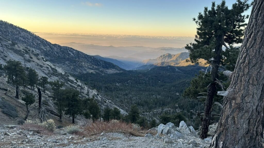
This is a big-day summit hike into the high country of the San Gabriels, and one of the most rewarding peaks we can reach within a couple hours of Santa Clarita. The route climbs steadily from Crystal Lake to the 9,138-foot summit of Throop Peak, where on a clear day the view stretches from the Mojave to the Pacific—Mt. Baldy, Mt. Baden-Powell, and Catalina Island all in one sweep. You earn it: the trail gains roughly 3,400 feet over exposed ridgeline, most of it in the first half.
From the Windy Gap Trailhead at the upper end of the Crystal Lake Recreation Area, the trail climbs about 2.1 miles through pine forest to Windy Gap, crossing two roads along the way (both clearly signed—stay on the Windy Gap Trail). At Windy Gap you join the Pacific Crest Trail heading toward Vincent Gap. From here the PCT climbs gently along a beautiful ridge with big views of the high peaks, past the Hawkins Ridge Trail junction and an unmarked spur to Mt. Hawkins, to an easy-to-miss use trail that leads up to Throop Peak. (If you reach the PCT sign for the Dawson Saddle Trail, you’ve gone too far—turn back.) After summiting, return the same way. This is high, dry, and exposed terrain with very little reliable shade and no dependable water—come prepared to be self-sufficient for the day.
DETAILS:
- Hike organizer(s): Tim R.
- Meet: Windy Gap Trailhead parking, upper lot of the Crystal Lake Recreation Area, Azusa, CA 91702, at 6:45, departure at 7:00 sharp (Aug 29).
- Distance: Approximately 11.8 miles (out-and-back).
- Elevation gain: Approximately 3,398 feet.
- Summit elevation: Approximately 9,138 feet (Throop Peak).
- Time: Approximately 7–8 hours hiking, depending on pace and time on the summit.
- Conditioning: You need to be in strong physical condition. This is a sustained, high-altitude climb with continuous elevation gain, long exposed stretches, and thin air above 8,000 feet. Prior experience at altitude and on hikes of this length is strongly recommended.
- Dogs: Not Allowed.
- Restrooms: Available at the trailhead parking area. None along the trail.
- Adventure Pass: Required. A National Forest Adventure Pass (or equivalent Interagency/federal pass) must be displayed in your vehicle to park at Crystal Lake.
IMPORTANT NOTES: There is little shade and no reliable water on the route—carry everything you’ll drink. The turn-offs for the peaks are easy to miss; stay on your downloaded map. Altitude affects people differently, even the fit—pace yourself and turn around if you feel unwell. As always, people may slip and fall, encounter wildlife, or face unexpected conditions on this hike. Finally, this event may be cancelled due to inclement weather.
ESSENTIAL GEAR: Sturdy trail shoes or boots with good tread for rocky, uneven footing. Trekking poles recommended for the sustained climb and descent. Hat, sunglasses, sunscreen, and sun-protective clothing—this trail is mostly exposed. A warm layer and windbreaker for the summit, where it’s cooler and windier than below. Snacks and a packed lunch. Refillable water bottles or reservoir with at least 3 liters; there is no reliable water on the trail.
The Ten Essentials of Hiking (link)
THIS HIKE RATING: Level 5, Advanced (see chart below).
Please only sign up to attend hikes that are consistent with your ability. Based on your hiking during the last 90 days, how would you score on the Santa Clarita Valley Hikers (SCVHikers) hike rating scale of one to five, assuming a moderate pace (~2.5 mph)?
SCVH HIKE RATING SCALE:
- Beginner: 1–3 miles, less than 500 feet elevation gain.
- Beginner/Intermediate: 1–7 miles, less than 700 feet elevation gain.
- Intermediate: 5–10 miles, 1000–2000 feet elevation gain.
- Intermediate/Advanced: 7–12 miles, up to 3000 feet elevation gain.
- Advanced: 10–17 miles, 3000 feet or more elevation gain.
TRAILHEAD LOCATION:
Windy Gap Trailhead, Crystal Lake Recreation Area (upper parking lot), Azusa, CA 91702 — approx. coordinates 34.3267, -117.8323. If your GPS struggles, navigate to the Crystal Lake Visitor Center (9877 N Crystal Lake Rd, Azusa, CA 91702) and follow signs to the Windy Gap trailhead parking.
NAVIGATION: We highly recommend the AllTrails app be installed on your cell phones and/or you print a copy of the trail map so you can personally navigate the trail if you need to. Cell service is unreliable up here—download your AllTrails maps for offline access before you leave home. The route follows the well-signed Windy Gap Trail and the PCT, but the summit use trails to Throop Peak are unmarked and easy to miss. Stay on the AllTrails route.
USFS Angeles NF – Road Status & Alerts (link)
If You Need Help on the Trail
In AllTrails, swipe up on the Navigate drawer and tap “GPS details” to see your coordinates. Screenshot them, then call 911 and read off the numbers. As a backup, the What3Words app names any location with three words that are easy to read aloud to a dispatcher. Your GPS works even without cell service—you just need signal to make the call.
We rely on donations to continue sponsoring hikes like this. Please contribute via cash or Venmo at each hike.
DISCLAIMER / RELEASE OF LIABILITY — PLEASE READ IN ITS ENTIRETY
When you sign up for this event, you are releasing Santa Clarita Valley Hikers (SCVHikers) and its volunteer organizers from any liability or responsibility in connection with your participation in this activity. Hiking is inherently risky. By signing up, you are taking full responsibility for your own safety and well-being.
SCVHikers and its organizers are not trained, certified, or compensated guides, and the club does not confirm the qualifications of any member to lead or participate in its events. All participants take full responsibility for their own actions and judgment.
By signing up for any SCVHikers event, you are releasing SCVHikers and its organizers from all liability for possible injury or death, as stated in paragraph 6.2 of the Meetup Terms of Service (available at the bottom of the Meetup website). Your personal safety depends on your own judgment and experience. If you sign up for this hike, you are confirming that the hike is within your current abilities.
At the trailhead, we will ask every participant to read and sign the SCVHikers Release of Liability and Express Assumption of Risk before the hike begins. If you are unwilling to sign, you will not be able to join the group that day. Signing up on Meetup does not substitute for the trailhead sign-in.
The outing begins and ends at the trailhead. SCVHikers does not organize, advertise, or coordinate carpools. Transportation to and from the trailhead is your own responsibility, and all risks of that travel are yours alone.
This event may be cancelled or modified due to weather, trail conditions, or other safety considerations.




