

3.5 miles, 700′ gain, easy-intermediate.
Short option: 2.0 miles, 500′ gain option.
There is an option to shorten this to 2.0 miles and 500′ of gain by skipping the 2nd loop, which starts from our social event area. The wait would be about 35 minutes for the rest of the group to complete the 2nd loop.
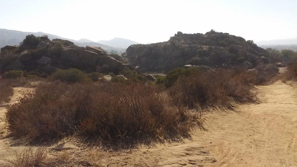
We’ll start this hike by parking on the south side of the CA-118 at the Rocky Peak exit. We’ll walk west along the Santa Susana Pass Rd. for about 500 feet, and directly across from Lilac Ln, we’ll enter a trail. We’ll move along a relatively flat section from 1/2 mile, then turn right and make a gradual climb until right before the wildlife tunnel.
Then we’ll take a set of switchbacks down into Corriganville. We’ll now be in front of a picnic pavilion. We’ll turn right and proceed to loop through the park, where we’ll pass an outdoor amphitheater, then make a mild climb to the top of a hill.
We’ll turn right, zig-zag down, and then make a left to the wide center trail that leads up through the park to its only parking lot. We won’t cross to the lot yet.
We’ll follow the trail as it bends to the right until it eventually bends back left and heads into the parking area. We’ll then walk along the side of the lot and head back to the picnic pavilion, where we’ll have a social event (https://www.meetup.com/Hiking-Plus/messages/boards/thread/50879772).
After the event, we’ll circle around the front of the pavilion and walk along railroad tracks for 200 yards towards the park lot. Behind a couple small shacks, we’ll turn left and cross the tracks, then head onto a trail and take this all the way back to Santa Susana Pass Rd. and then our cars.
The park officially closes at sunset, so we’ll try to start heading back before dark.
Interesting Notes:
Here are a couple plants you are sure to see on this hike:
California Sagebrush
Aromatic when crushed. AKA, common sage, coastal sage. Sunflower family. Cowboys used to ride through it and brush up against the pine-shaped leaves, coming home with the smell on their clothes and giving rise to the nickname “Cowboy Cologne.” Not a true sage. Can be used as a cooking spice and can be made into a tea. Tear off some needles by running your hand up the stalk and smell the aroma.
Purple Sage
Grey-green leaves. Aromatic when crushed. Purple flowers. Aka, Tobacco Sage, with mild hallucinogenic properties when smoked. Can be used as a spice or made into a tea. Tea has medicinal affects: Antiviral, gargle for sore throats, reduce hay fever symptoms and other drying actions. In the last summer, fall, and winter months, the flowers will have turned brown and the leaves we take on a greyer color.
Directions:
Rocky Peak Exit, South Side of CA-118
Simi Valley, CA 93065
34.268396, -118.636139
From the 118
Exit 32 Rocky Peak Rd.
Park on south of the freeway along Santa Susanna Pass Rd.
From the 101 @ CA-23
North CA-23 for 8.4 miles.
East I-118 for 14 miles.
Exit 32 Rocky Peak Rd.
Park on south of the freeway along Santa Susanna Pass Rd.

The Hike:
Distance: 3.5 miles
Elevation Gain: 700′
Difficulty: Easy Intermediate (https://www.meetup.com/Hiking-Plus/messages/boards/thread/50879781).
Pace: 2.0 mph
Dogs: Yes.
Restrooms: Yes, at the picnic pavilion.
Drinking Fountains: Yes
Parking: Free, south side of CA-118
Trail: Single Track, Double Track, and fire road.
Purpose: Social
What to Bring:
1-2 liters of water.
Snacks and/or beverages to share (https://www.meetup.com/Hiking-Plus/messages/boards/thread/50879772).
Hiking shoes preferred, but athletic shoes will be OK.
Flashlight or headlamp. The last 30 minutes may get dark.
Disclaimer / Release of Liability:
https://www.meetup.com/Hiking-Plus/pages/29622459/Is_Hiking_Dangerous/


