

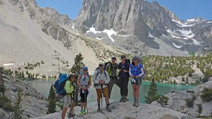
Trying a new route and avoiding a car shuttle this time around. Limiting the number of attendees since it’s exploratory and going to be a long day/hike.
Write up is Don’s:
The Stats
Distance: 16 miles
Elevation Gain: >4000
Rating : 9/10, for the experienced only – not for beginner or slow hikers
Trail: Uneven rocky terrain and single track, bushwhacking and some creek crossing, scrambling and a bit of fire road. VERY steep uphill.
The Plan
We will meet at the trailhead for Trail Canyon Falls to start our hike. NO car shuttle this time around. The trail follows Gold Creek and goes by some rustic cabins from the 1920’s, it continues along the creek heading up this amazingly deep canyon. At about 1.5 miles from the beginning we’ll get our first view of the falls. Our first break will be at the 2 mile mark at the base of the waterfall. We’ll stop for some pictures then venture on above the falls. This is where a large portion of our gain comes in – 3000 feet in less than 3 miles and will include scrambling on rocks. Once we reach Condor, we will have a lunch break and head back down the regular trail back towards the falls. There will likely be a small portion of bushwhacking and trail finding as we did have some difficulty locating an actual trail the last time we did this.
The Story
Condor Peak (elev. 5540) stands high above Big Tujunga Canyon, across from Mount Lukens, and west of Josephine Peak. On a clear day it commands superb views of the western San Gabriel Mountains. If you come in the spring when the Ceanothus is in bloom, you will be treated to a show of beautiful lilac-colored flowers.
The peak is named after the endangered California Condor (Gymnogyps californianus). A hundred years ago it was a nesting ground for the “monarchs of the air”, and they could be seen wheeling gracefully overhead in search of something dead to eat. Sadly, the condor’s numbers have declined dramatically. The last condor sighting in the area was before World War II.
Directions:
Leave any valuables at home and take all important items (keys, phone, wallet, etc.) on the hike with you. Don’t leave anything of any importance in your car.
210 West exit at Sunland Blvd. (#11) and turn right (N) towards Sunland – Tujunga
210 East exit at Sunland Blvd (#11) and turn left (N) towards Sunland – Tujunga
Take Sunland Blvd which becomes Foothill Blvd. about .8 miles to Oro Vista Ave and turn left. There’s a Jack In The Box and 7-11 on the left and a Shell station on the right at Oro Vista Ave. Stay on Oro Vista Ave and it curves to the right and becomes Big Tujunga Canyon Road which will take you to the trailhead. The turnout, NF 3n-29, is easy to spot, but not marked very well. It’s about 4.7 miles in from the curve at the end of Oro Vista Ave. It’s just before mile marker 2.05. If you pass Ottie Road you went too far. Park on Big Tujunga or in the turnout but be sure to read the parking signs and don’t block the gate.
For those GPS people out there these coordinates are for where NF 3n-29 meets Big Tujunga: N34 18.224 W118 15.490.
This location does not require a National Forest Adventure Pass.
**************************
The Fine Print
PLEASE – Know your limits and abilities. Bring snacks and drink plenty of liquids when hiking. Check weather conditions and dress accordingly and be aware of your surroundings at all times. Watching out for poison oak, snakes, ticks, uneven footing, spectacular views, beautiful fauna all while interacting with awesome (usually) fellow hikers can be extremely hazardous, rewarding and fun.
The Farzan Rule: Posted hike times are the time the hike starts or we leave from a posted shuttle location. I’m aware other Meetup groups offer a grace period for late arrivals; we don’t. It’s your responsibility to know the location of the meeting spot and be there and ready to participate at the posted time. If you have any concerns about the directions feel free to contact the organizer of the event, preferably in advance of the event and not at the start time. I’m of the opinion that it’s not fair to delay an event when the majority of attendees have arrived on-time. (so named after a conversation I had with a certain un-named member)
RSVP’s: If you RSVP for an event be responsible and update your RSVP if your plans change. If your plans change at the last second and you’re not able to update your RSVP also let us know. In my opinion a no-show is someone who has no regard for following the guidelines we request from our members and will risk being removed from future events that have a limit.
VHC HIKE RATING SCALE
Rating a hike is subjective, meaning the difficulty of a hike will be in direct relation to how often you hike and the type of hike you prefer. Keep in mind that any hike can have the following: un-even hiking surfaces, various obstructions, water and/or water crossings or bouldering and/or rock hopping. A great hike will have all of these!
1 – A long walk
2 – 4 mile hike w/little elevation gain
3 – 5 mile hike w/up to 1000 ft. elevation gain
4 – 5+ mile hike w/up to 1500 ft. elevation gain (heart rate increases at times)
5 – 7+ mile hike w/over 1500 ft. elevation gain (heart rate increasing even more at times)
6 – 7+ mile hike w/over 2000 ft. elevation gain (at times you might be trying to remember how to perform CPR)
7 – 5+ mile hike w/over 2000 ft. elevation gain (at times you might be muttering expletives to yourself)
8 – 10+ mile hike w/over 3500 ft. elevation gain (at times you might be angry with the hike leader)
9 – 10+ mile hike w/over 5000 ft. elevation gain (at times you might be thinking of reporting the hike leader to the authorities)
10 – Use your imagination
Class 3 Scrambling: Scrambling or un-roped climbing. You must use your hands at times to hold the terrain or find your route. This may be caused by a combination of boulders, steepness and extreme terrain. Some Class 3 routes have ropes in place for assistance.
DISCLAIMER / RELEASE OF LIABILITY
IMPORTANT, PLEASE READ BELOW IN ITS ENTIRETY:
I am a volunteer (i.e. not liable for the group). Safety is a priority for everyone in the group. Think of this as hiking with a group of friends.
Outdoor sports and other events we plan can be inherently dangerous and accidents may happen. By participating in any posted event, you’re taking responsibility for your own safety and well-being. The Valencia Hiking Crew Meetup Group and its organizers are not trained leaders and we do not confirm the qualifications of any of its members to lead or participate in trips. All participants take full responsibility for their own actions. If you choose to sign up for any Valencia Hiking Crew Meetup events, you are releasing the Valencia Hiking Crew Meetup Group and it’s organizers from all liability in case of possible injuries as stated in paragraph 6.2 of the Meetup “Terms of Service” located on the bottom of the Meetup website. Your personal safety depends on your own judgment and experience.
Outdoor sports and other events we plan can be inherently dangerous and accidents may happen. By participating in any posted event, you’re taking responsibility for your own safety and well-being. The Valencia Hiking Crew Meetup Group and its organizers are not trained leaders and we do not confirm the qualifications of any of its members to lead or participate in trips. All participants take full responsibility for their own actions. If you choose to sign up for any Valencia Hiking Crew Meetup events, you are releasing the Valencia Hiking Crew Meetup Group and it’s organizers


