

BEFORE YOU WILL BE MOVED TO THE GOING LIST, YOU WILL NEED TO UPDATE YOUR CDH PROFILE (The three questions must be answered with a “yes”) IF YOU HAVE NOT ALREADY DONE SO.
NEED HELP:
go to: [https://wp.me/P9MbG4-hC](https://wp.me/P9MbG4-hC)
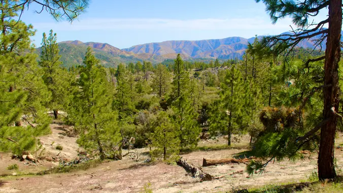
This trek will allow us to venture out on a small section of the two longest trail systems in the Angeles National Forest (Pacific Crest Trail and The Silver Moccasin Trail). We’ll do this by a way of a loop hike.
MEETUP LOCATION AND TIME: 6:30am at the Woodland Hills Meetup location. Those who want to carpool from Woodland Hills, can meet me at the corner of Leonora and Ponce Avenue. Ponce is the first street east of Fallbrook. We can park on Ponce which is not in front of any houses.
IF MEETING HERE, LET ME KNOW.
SEE MAP SITE BELOW
[https://www.google.com/maps/place/34%C2%B010’04.0%22N+118%C2%B037’16.0%22W/@34.1677751,-118.6216512,228m/data=!3m2!1e3!4b1!4m6!3m5!1s0x0:0x0!7e2!8m2!3d34.1677741!4d-118.6211043](https://www.google.com/maps/place/34%C2%B010’04.0%22N+118%C2%B037’16.0%22W/@34.1677751,-118.6216512,228m/data=!3m2!1e3!4b1!4m6!3m5!1s0x0:0x0!7e2!8m2!3d34.1677741!4d-118.6211043)
ALTERNATE MEETUP LOCATION AND TIME: 7:15 am at the meetup location on Hwy. 2 in La Canada. (BOOTS ON, READY TO GO). IF MEETING THE GROUP HERE, YOU MUST STATE SO, OTHERWISE I WON’T BE STOPPING HERE.
ALTERNATE MEETUP DIRECTIONS: From the 210 Fwy, exit at Angeles Crest Hwy and drive north about a quarter mile to just past Milmada Dr. in LA CANADA, then park alongside the road. We will all meet here no later than 7:15 a.m. and take as few cars as possible to Chilao.
[https://www.google.com/maps/place/34%C2%B012’31.6%22N+118%C2%B012’00.4%22W/@34.208775,-118.2014418,510m/data=!3m2!1e3!4b1!4m6!3m5!1s0x0:0x994c9cddd846e440!7e2!8m2!3d34.2087745!4d-118.2000962](https://www.google.com/maps/place/34%C2%B012’31.6%22N+118%C2%B012’00.4%22W/@34.208775,-118.2014418,510m/data=!3m2!1e3!4b1!4m6!3m5!1s0x0:0x994c9cddd846e440!7e2!8m2!3d34.2087745!4d-118.2000962)
EXPERIENCE LEVEL: Advanced beginners on up
DISTANCE: 5 miles
ELEVATION GAIN/LOSS: 700’/700′
TRAIL DESCRIPTION: Mostly trails, but a section linking up the two trails will be exploratory with possible off trail trekking.
THE PACE: Slow pace
ROUTE: [https://www.alltrails.com/explore/map/bit-of-pct-silver-mocasin-trails-1fc30b9](https://www.alltrails.com/explore/map/bit-of-pct-silver-mocasin-trails-1fc30b9)
DURATION: We’ll want to finish the hike and be back to the cars by 1:00 p.m. at the latest, followed by lunch at The Habit Burger Grill in La Canada.
MY CELL #: 805-358-5972


