


Join us for a classic San Gabriel Mountains adventure that pairs high-elevation alpine views with rich Southern California mining history!
📅HISTORY OF THE AREA
This trail traces the steps of Charles “Tom” Vincent, a Civil War veteran and hunter who lived in solitary self-reliance in these mountains starting in the 1860s. In 1895, while tracking a bighorn sheep along the steep crags of Mount Baden-Powell, Vincent spotted quartz veins gleaming with gold. His discovery sparked the creation of the Big Horn Mine. Tens of thousands of dollars in gold were extracted over the following decades, leaving behind fascinating historic structures hidden high above the canyon floor.
👁️HIKE OVERVIEW & VIEWS
We’ll tackle this hike as a ~4-mile loop (with roughly 1,000 feet of total ascent) combining dense timbered gulches, historic artifacts, and sweeping canyon vistas.
- Vincent’s Cabin: Starting at Vincent Gap (~6,600 ft elevation), we drop down the forested Vincent Gulch Trail into a shaded ravine lined with towering Jeffrey pines, sugar pines, and white firs. Hidden in the trees sits Vincent’s remarkably preserved 19th-century log cabin.
- The Connector & Mine Road: From the cabin, we climb a short, steep connector trail that ascends through pine duff to join Big Horn Mine Road. As we head along this wide shelf carved into the cliff face, the canopy opens up to dramatic, sweeping views overlooking Mine Gulch, the East Fork San Gabriel River gorge, and the rugged wilderness of the Sheep Mountain area.
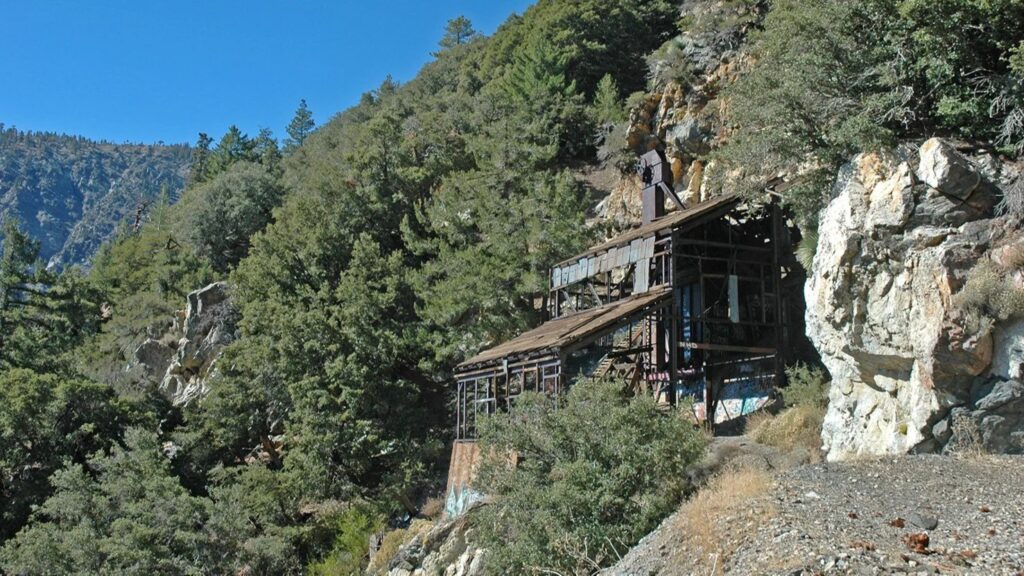
- The Stamp Mill Ruins: The highlight of the route is the massive, weathered wooden stamp mill clinging to the mountainside. Here, we can admire the historic timber framework and catch the chilly draft flowing from the gated mine portal.
- Flora & Fauna: Along the trail, keep an eye out for high-country wildlife—including Nelson’s bighorn sheep perched on the rocky ledges, mule deer, and Steller’s jays—and don’t forget to catch the butterscotch-vanilla scent of the Jeffrey pine bark along the ridge!
🚶➡️TRAIL DETAILS
- Distance: ~4 miles round-trip (Lollipop)
- Total Ascent: ~1,000 feet
- Difficulty: Medium due to terrain. See the HWD Rating Guide.
- What to Bring: Sturdy hiking boots, 2+ liters of water, snacks/lunch, sun protection, and a camera for the mountain vistas!
🚗DIRECTIONS
On Angeles Crest Hwy park at the Vincent Gap Parking lot. No pass is needed. Parking is free for us
⚠️Angeles Crest Hwy (Hwy 2) is closed in some areas. There is no access from La Canada or Azuza. Consult Google Maps for best directions from your location.




