• Hike at Laguna Coast Wilderness Park – Willow Staging Area

    Willow Staging Area 20101 Laguna Canyon Road, Laguna Beach, CA, US

    The hike we will be doing is a loop at about 5.5 miles with 725 ft. of elevation gain. We will meet at the Willow Staging Area that is right off of the 133. We will begin at the trail head of the Laurel Canyon Trail. We will take this to Lizard Trail, then we […]

  • Say Cheeseboro Canyon to Palo Comado Canyon ~ Intermediate Hike

    Cheeseboro Canyon Trailhead Upper Parking Lot Cheseboro Canyon Road, Agoura Hills, CA, US

    Let’s revisit a trail that we haven’t hiked in quite awhile. http://photos4.meetupstatic.com/photos/event/4/e/0/4/event_85459972.jpeg Tucked along the 101 in Agoura is the northernmost section of the Santa Monica Mountains National Recreation Area. Echoing its not-so-distant past of ranching, the rolling hills and shady canyons are popular with equestrians. Before the ranchers, Chumash Indians and grizzly bears tromped […]

  • Hill Canyon Santa Rosa Regional Park

    Hill Canyon Trailhead 10241 Hill Canyon Road, Camarillo, CA, US

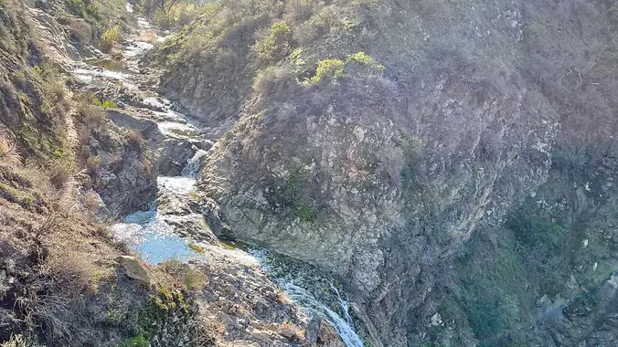
    This is the slower hike for Tuesday, there will be a faster hike posted as well. This hike is in Camarillo at Hill Canyon in Santa Rosa Regional Park. We will start at the parking area in Hill Canyon, cross the bridge over the runoff creek, and stroll a mile before turning onto the fire […]

  • Mt. McCoy

    Clinicas Del Camino Real Inc - Madera 1424 Madera Road, Simi Valley, US

    Easy Intermediate, 3 miles, 700' gain Easier Option: 2.4 mi, 530' gain. (1343 Los Amigos Ave, Simi Valley, CA 93065, or 89 La Paz Ct, Simi Valley, CA 93065 to save another 500' distance). We'll meet in the parking lot at the northeast corner of Madera and Royal, just south of the Donut Delite, on […]

  • Rosewood Trail: Lynn to Angel Vista – Gentler Intermediate

    150 Regal Oak Ct 150 Regal Oak Ct, Thousand Oaks, CA, US

    Meet at the Rosewood sign, which is on the Regal Oak Ct. and Lynn Rd. intersection. The hike is about 5 miles with an elevation gain/loss approximately 900’. We'll walk a short distance on Lynn road to the lower Rosewood Trail, then take the dirt trail up a shaded ravine and continue on the Rosewood […]

  • Wildwood Central Park (Fast Paced)

    Wildwood Regional Park 928 W Avenida De Los Arboles, Thousand Oaks, CA, US

    With the limited daylight we will do this shorter hike. Wildwood Park in Thousand Oaks is one of the most versatile local parks there is, with 27 miles of trails skittering through rocky cliffs, cacti-filled desert environs, volcanic rock, riparian forest, and a cool, watery canyon. Highlights of the hike include waterfalls incorporating 40’ Paradise […]

  • Hike at Whiting Ranch – Wahoo’s Parking Lot

    Wahoo's Fish Taco 27412 Portola Parkway, Foothill Ranch, CA, US

    This hike will be about 5.4 miles total with 820 ft. of elevation gain. We are starting at the parking lot at the Wahoo's parking lot. We will take Live Oak Trail. This turns into Serrano Road which will take us to Serrano Cow Trail. At this part of the trail, we usually see a […]

  • Western Plateau Mt. Elliott – Gentler Friendly – 8:30 Start

    Conejo Canyons Trail Head 2010 Conejo Center Dr, Thousand Oaks, CA, US

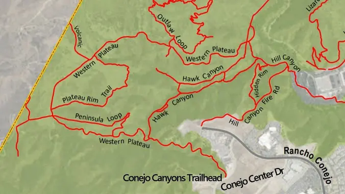
    Meet at the Conejo Canyons trailhead next to the Thousand Oaks Recycling Center on Conejo Center Drive, near the end of Rancho Conejo. We'll walk across Rancho Conejo and take the fire road down to new bridge construction site and then we will go to Five Points. From Five Points, we will take the Western […]

  • Zuma Canyon: Ocean and Canyon View trail Loop ~ Gentler Intermediate

    Zuma Canyon Trailhead 5721 Bonsall Dr, Malibu, CA, US

    This is an alternative hike to Peter's hike on Thursday. It's a bit far on PCH, but we will meet at 9:00 AM. The name “Zuma” is derived from the Chumash language and means “abundance.” There is an absolute abundance of beautiful and spectacular wildflowers engulfing the entire area and it appears that there was […]


Trail statistics are approximate. For safety purposes always assume they are underestimated. But don’t be disappointed if they are overestimated. Bring more water and snacks than you think you’ll need.

Trail descriptions are based on previous hikes. Current conditions are unknown until arrival. Expect the unexpected and plan accordingly.

The Organizers and members of Hiking With Dean are not professional leaders, guides, or mountaineers. The function of the member or organizer is only to organize the trip. Each person who shows up for a trip/meetup (and their guest or guests) is responsible for his or her own safety. By attending a hike, or any other event organized by this group, you are acknowledging that you and any guests that you bring are aware of the risks, dangers and hazards associated with the activity and freely accept and fully assume all such risks, dangers and hazards, and further agree to release and discharge the Organizers, Members of the Hiking With Dean Meetup Group from and against any and all liability arising from your participation in the group activities per our ASSUMPTION OF RISK AND LIABILITY WAIVER and Section 6.2 of the Meetup.com Terms of Service.