Site Search

Hiking Calendar

Bike Norwalk Metro Station to Seal Beach on San Gabriel River Bike Path 28 miles

Norwalk Metro Station (Green Line) 12901 Hoxie Avenue, Norwalk, CA, US

Join us for bicycling on the San Gabriel River Bicycle Path from Norwalk Metro Station (Green Line) to Seal Beach. This enjoyable bike ride is 28 miles roundtrip on flat bike paths and roads. See a map of this route at https://goo.gl/maps/UIkv2 ___________________________________ *** Please join the Southern California Cycling Group at https://www.meetup.com/cyclegroup/ now to […]

Los Padres – Mother’s Day Hike with Potluck Picnic stop

Los Padres Trailhead 15 Los Padres Drive, Thousand Oaks, CA, US

**3.5 miles, 700' gain, Easy Intermediate.** Easy Option: 2.4 miles, 340' gain, Fit Beginner. Happy Mother's Day to all beings who have a motherly heart! Let's embrace this opportunity and enjoy a potluck hike with the beautiful Mother nature and great friends. We'll start by entering the Los Padres trail, through a spooky oak covered […]

EBIKE RIDE – RIDGE LINE OVER LOOKING SANTA BARBARA – East Camino Cielo Rd.

Charmlee Wilderness Park 2577 S. Encinal Canyon Road, Malibu, CA, US

BEFORE YOU WILL BE MOVED TO THE GOING LIST, YOU WILL NEED TO UPDATE YOUR CDH PROFILE (The three questions must be answered with a "yes") IF YOU HAVE NOT ALREADY DONE SO. NEED HELP: (go to: https://wp.me/P9MbG4-hC) BIKE RIDE ALONG THE PAVED ROAD ON THE RIDGELINE ABOVE SANTA BARBARA I like scenery and great […]

Talopop – Suitable for fit beginners

Talopop at Juan Bautista de Anza Park 3701 Lost Hills Road, Calabasas, CA, US

**Fit Beginner, 4.1 miles, 720' gain.** **Easier route: 3.9 miles, 500' gain.** Is it Talepop or Talopop? Maps and signs that I have seen, use the 2nd spelling, but a lot of references use the other. We'll meet in front of the facilities building at the center of the park. This is a lollipop hike. […]

SANTA BARBARA COASTAL RANGE TREK (ROCK GARDEN AND WHITE MOUNTAIN)

Upper Rattlesnake Canyon trailhead on Gibraltar Road Gibraltar Road, Santa Barbara, ca, US

BEFORE YOU WILL BE MOVED TO THE GOING LIST, YOU WILL NEED TO UPDATE YOUR CDH PROFILE (The three questions must be answered with a "yes") IF YOU HAVE NOT ALREADY DONE SO. NEED HELP: go to: (https://wp.me/P9MbG4-hC) SANTA BARBARA COAST- SERIES OF HIKES Join me on yet another CDH series as I take on […]

Angel Vista – Easy Intermediate

Rosewood Trailhead 305 Regal Oak Ct, Thousand Oaks, CA, US

**3.0 miles, 800' gain, easy-intermediate.** This hike is rated easy-intermediate because it is a continuous incline for 1.5 miles. This isn't real steep, but it is continuous, and many beginner hikers have indicated this should be rated intermediate. That said, there is no reason a fit beginner cannot complete this hike. If needed, just stop […]

Strawberry Peak via Redbox Canyon

Strawberry Peak Trailhead Strawberry Peak trail, Palmdale, CA, US

https://www.alltrails.com/trail/us/california/strawberry-peak-trail-via-redbox-canyon Hello Fellow Hikers, This is also one of the 6 peak challenges. This one starts across from Redbox and has a nice gradual climb. Until you get to your turn off to head up to Strawberry Peak then the fun begins. This one can mess with your mind due to all the false peaks […]

Mt. Baldy via the Ski-Hut Trail – Return via the Notch

Manker Flats Parking Area Mount Baldy Road and Falls Road, Mount Baldy, CA, US

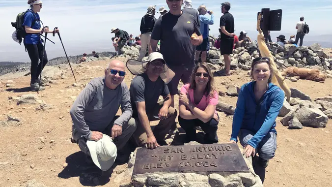
Hike to the summit via the Ski Hut trail and descend via the Backbone trail to the Notch and then via the service road back down to Manker Flats or take the lift, your choice Bring snacks for the summit and trail. Advanced Intermediate Hikers. You should have Mt. Baldy Summit experience via the Backbone […]

It’s a house party!

23759 Roscoe Blvd 23759 Roscoe Blvd, Canoga Park, CA, US

The theme is "Come as you are". To attend this party, the host must know you. Potluck and BYOB. Please bring a dish and drink to share. Location is approximate. Those on the RSVP list will be sent the address the day before the party. Contact the organizer on the day of the party if […]


Trail statistics are approximate. For safety purposes always assume they are underestimated. But don’t be disappointed if they are overestimated. Bring more water and snacks than you think you’ll need.

Trail descriptions are based on previous hikes. Current conditions are unknown until arrival. Expect the unexpected and plan accordingly.

The Organizers and members of Hiking With Dean are not professional leaders, guides, or mountaineers. The function of the member or organizer is only to organize the trip. Each person who shows up for a trip/meetup (and their guest or guests) is responsible for his or her own safety. By attending a hike, or any other event organized by this group, you are acknowledging that you and any guests that you bring are aware of the risks, dangers and hazards associated with the activity and freely accept and fully assume all such risks, dangers and hazards, and further agree to release and discharge the Organizers, Members of the Hiking With Dean Meetup Group from and against any and all liability arising from your participation in the group activities per our ASSUMPTION OF RISK AND LIABILITY WAIVER and Section 6.2 of the Meetup.com Terms of Service.