Site Search

Hiking Calendar

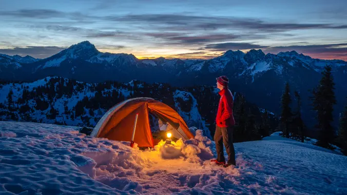
Yosemite – Snow Camping (Glacier Point Area)

Red Box Angeles National Forest, CA, United States

Snowshoes /cross country skies Required Yosemite - Snow Camping Location: To be determined Winter transforms Yosemite’s familiar landscapes; exploring in winter is like finding a whole new park. But winter is less forgiving for the wilderness traveller, and some extra precautions are in order. NOT FOR BEGINNERS (We reserve the right to deny or remove […]

Late Morning Hike at Whiting Ranch – Wahoo’s Parking Lot

Wahoo's Fish Taco 27412 Portola Parkway, Foothill Ranch, CA, US

This hike will be about 5.4 miles total with 820 ft. of elevation gain. We are starting at the parking lot at the Wahoo's parking lot. We will take Live Oak Trail. This turns into Serrano Road which will take us to Serrano Cow Trail. At this part of the trail, we usually see a […]

Malibu Creek SP Visitor Center (Arrive Anytime)

Malibu Creek State Park Visitor Center - HWD Agoura Hills, CA, United States

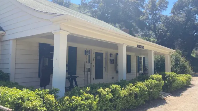
I'll be working in the Malibu Creek State Park Visitor Center on this Sunday. We are open from Noon to 4pm. Stop by and say hello -- and for a private tour. About the VC The MCSP Visitor Center (VC) is a historic building and is over 100 years old. Malibu Creek Docents operate the […]

Exploring Caves – Hike at Aliso and Wood Canyons Park

Canyon View Staging Area 22124 Utility Access, Aliso Viejo, CA, US

We are going to be starting at the Canyon View Staging Area. This hike is roughly 7 miles with relatively low elevation gain. The expectation is to definitely make it to Cave Rock and Dripping Cave. Hopefully we see animals too! Link to Parking from Google Maps: https://www.google.com/maps/place/Canyon+View+Staging+Area/@33.585273,-117.7465062,17z/data=!3m1!4b1!4m5!3m4!1s0x80dce61b6bd45c2d:0x5ef3f1ad687cc8b5!8m2!3d33.585273!4d-117.7443175 Dogs are not allowed at this park. […]

Moores Canyon – Upper Las Virgenes – Kenneth Fire Assessment

El Escorpion Trail Vanowen Street 24480, West Hills, CA, United States

Part of this loop hike will be through the Kenneth Fire burn area. Today we'll be trapsing around the northern section of the Upper Las Virgenes Open Space Preserve in the Simi Hills. At the western edge of the San Fernando Valley, it is part of a critical ecological linkage and wildlife corridor between the […]

Angel Vista – Potluck hike

Rosewood Trailhead 305 Regal Oak Ct, Thousand Oaks, CA, US

3.0 miles, 800' gain, easy-intermediate. Photo by Helen Let's enjoy the gorgeous sunset and fun loaded potluck picnic at the beautiful Angel Vista! This is a potluck hike. Please bring food, drinks to share. If your item requires utensils/plates/toothpicks, etc., please bring them. You may wish to bring your own cup, plate, and utensils in […]

China Flat & Simi Peak ~ Gentler Intermediate

1400 King James Ct 1400 King James Ct, Oak Park, CA, US

This hike begins from the top of King James Court, a cul-de-sac off Lindero Canyon Road. Begin up the trail at the top of the road, passing through a gate by a sign that reads “China Flat Trail Head.” It will pass through the branch of Suicide Trail and another branch of China Flat Trail. […]

Rancho Sierra Vista, Peace, Love, and Joy ~ Intermediate Hike

Rancho Sierra Vista Rancho Sierra Vista/Point Mugu, Newbury Park, CA, US

Let's head out to the famed Peace, Love, Joy arch at the Danielson. This out and back hike wanders through grasslands and chaparral from the Rancho Sierra Vista trailhead, then climbs up Danielson fire road for some fantastic views north to Port Hueneme and Oxnard and west toward the Pacific Ocean. If it's really clear, […]

Mt. McCoy

Clinicas Del Camino Real Inc - Madera 1424 Madera Road, Simi Valley, US

Easy Intermediate, 3 miles, 600' gain Easier Option: 2.4 mi, 530' gain. (5 Washburn St, Simi Valley, CA 93065, or 89 La Paz Ct, Simi Valley, CA 93065 to save another 500' distance). We'll meet in the parking lot at the northeast corner of Madera and Royal, just south of the Donut Delite, on the […]


Trail statistics are approximate. For safety purposes always assume they are underestimated. But don’t be disappointed if they are overestimated. Bring more water and snacks than you think you’ll need.

Trail descriptions are based on previous hikes. Current conditions are unknown until arrival. Expect the unexpected and plan accordingly.

The Organizers and members of Hiking With Dean are not professional leaders, guides, or mountaineers. The function of the member or organizer is only to organize the trip. Each person who shows up for a trip/meetup (and their guest or guests) is responsible for his or her own safety. By attending a hike, or any other event organized by this group, you are acknowledging that you and any guests that you bring are aware of the risks, dangers and hazards associated with the activity and freely accept and fully assume all such risks, dangers and hazards, and further agree to release and discharge the Organizers, Members of the Hiking With Dean Meetup Group from and against any and all liability arising from your participation in the group activities per our ASSUMPTION OF RISK AND LIABILITY WAIVER and Section 6.2 of the Meetup.com Terms of Service.