Site Search

Hiking Calendar

Stair Hike: Under the Banner of Blue Heaven #2 – 4.5 miles

Bellevue Recreation Center Lucile Avenue 826, Los Angeles, CA, United States

Let’s explore the winding streets of Silver Lake as we discover a bit of Hollywood History by climbing the Music Box Steps, made famous by the classic comedy film duo, Laurel and Hardy! While this comedy duo was pre L.A. Dodgers, in their heyday they would have made our Boys in Blue proud with their […]

Peter Repeater: Peters Cyn hiking, Peet’s Coffee for socializing!

Peters Canyon (South Entrance) Silverado Terrace 10992, Tustin, CA, United States

start your year with this post-holiday conditioning hikes. Join us for a Friday morning hike at Peter's Canyon. We'll do a six mile loop starting at the south entrance. After the hike, feel free to join us for coffee at Peet's in Tustin. This is a great hike for people wanting to learn about WTC […]

Sagebrush Cantina: Hindsite

Sagebrush Cantina 23527 Calabasas Rd, Calabasas, CA, United States

Many from this group, plus other friends, will attend this event at Sagebrush Cantina. The band playing (Hindsite) puts on a fantastic show, playing dance, pop, r&b/funk, and hip hop music from the 70's up to the latest hits. This is one of the best venues I've experienced on LA's west side, and this is […]

Hike at Caspers Wilderness Park – Bell Canyon + Oso Trail + In-N-Out after

Caspers Wilderness Park 33401 Ortega Hwy, San Juan Capistrano, CA, US

The hike I am planning is around 6.3 miles with about 700 ft. of elevation gain. It starts at the very end of the paved road, the long gray strip that can be seen on the map. We will begin at the Bell Canyon Trail head. We will continue onto that and then take it […]

Hike at Aliso and Wood Canyons Park – Up Cholla, Down Mathis

Canyon View Staging Area 22124 Utility Access, Aliso Viejo, CA, US

We are going to be starting at the Canyon View Staging Area. This hike will be about 6.2 miles with around 1,000 ft. of elevation gain. We will be starting at Canyon View Park and taking Cholla up to West Ridge and comic down Mathis. Link to Parking from Google Maps: https://www.google.com/maps/place/Canyon+View+Staging+Area/@33.585273,-117.7465062,17z/data=!3m1!4b1!4m5!3m4!1s0x80dce61b6bd45c2d:0x5ef3f1ad687cc8b5!8m2!3d33.585273!4d-117.7443175 Dogs are not […]

Hawk Canyon lollipop – Potluck hike

Conejo Canyons Trail Head 2010 Conejo Center Dr, Thousand Oaks, CA, US

4.2 miles, 700' gain, easy-intermediate. Easier option: 2.7 miles, 500' gain, fit beginner. This is a pot-luck hike. We'll be stopping at the 3/4 point by a picnic table, so please bring food and drink to share, and any utensils your items might require. You may wish to bring your own cup, plate, and utensils […]

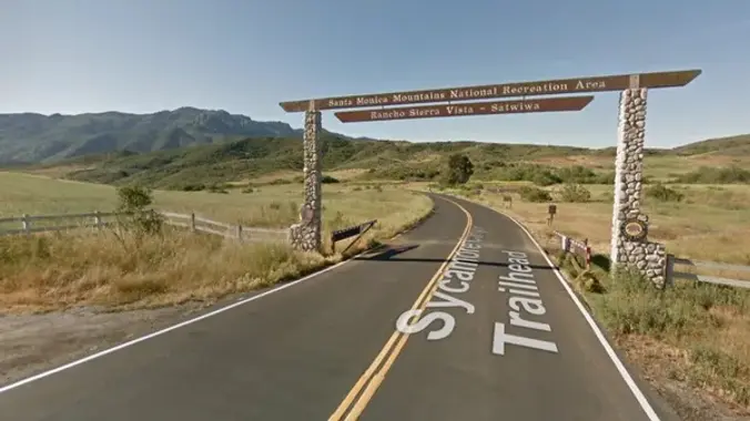
Rancho Sierra Vista/Satwiwa trail loops hike ~ Gentler Intermediate

Rancho Sierra Vista/Satwiwa Main Parking Lot Pinehill Avenue, Newbury Park, ca, United States

"Satwiwa" is Chumashan and directly translates to "the bluffs," which can also translate to "higher places," and is the Chumashan name used for a former village near the current culture center. The Ranch Overlook Trail extends from just west of the culture center to the Palomino Trail in the Rancho Potrero Open Space. https://www.conejovalleyguide.com/dosomethingblog/ranch-overlook-trail-in-rancho-sierra-vistasatwiwa-in-newbury-park This […]

Say Cheeseboro Canyon to Palo Comado Canyon ~ Intermediate Hike

Cheeseboro Canyon Trailhead Upper Parking Lot Cheseboro Canyon Road, Agoura Hills, CA, US

http://photos4.meetupstatic.com/photos/event/4/e/0/4/event_85459972.jpeg Tucked along the 101 in Agoura is the northernmost section of the Santa Monica Mountains National Recreation Area. Echoing its not-so-distant past of ranching, the rolling hills and shady canyons are popular with equestrians. Before the ranchers, Chumash Indians and grizzly bears tromped out the slender trails in the native grasses that became today's […]

BACKPACKING LEADERSHIP: For Advanced Backpackers

Online event

Invite Only. This meeting serves as a continuation of our collaborative leadership discussion and will take place over Zoom. Topics: ✔️ Creating an event on Meetup. 🥾 Step-by-step screen sharing and walk through. By participating in this event, you acknowledge you are ultimately responsible for yourself and your safety while engaging in this activity and […]


Trail statistics are approximate. For safety purposes always assume they are underestimated. But don’t be disappointed if they are overestimated. Bring more water and snacks than you think you’ll need.

Trail descriptions are based on previous hikes. Current conditions are unknown until arrival. Expect the unexpected and plan accordingly.

The Organizers and members of Hiking With Dean are not professional leaders, guides, or mountaineers. The function of the member or organizer is only to organize the trip. Each person who shows up for a trip/meetup (and their guest or guests) is responsible for his or her own safety. By attending a hike, or any other event organized by this group, you are acknowledging that you and any guests that you bring are aware of the risks, dangers and hazards associated with the activity and freely accept and fully assume all such risks, dangers and hazards, and further agree to release and discharge the Organizers, Members of the Hiking With Dean Meetup Group from and against any and all liability arising from your participation in the group activities per our ASSUMPTION OF RISK AND LIABILITY WAIVER and Section 6.2 of the Meetup.com Terms of Service.