• Rosewood Trail to Angel Vista – Gentler Intermediate

    150 Regal Oak Ct 150 Regal Oak Ct, Thousand Oaks, CA, US

    We will start (early to beat the heat) our hike near the beginning of Regal Oak Ct. on the lower Rosewood Trail, a dirt trail heading up a shaded ravine at the base of the mountains, and continue to the usual Rosewood trail. Rosewood trail presents a clear view over the 101 Freeway carving up […]

  • Los Robles/Moorpark Trail

    Los Robles Trail 351 S Moorpark Rd, Thousand Oaks, CA, US

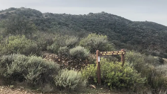
    NOTE: This is an alternative hike for Tuesday. We will take this Los Robles trail with lots of trees and shade. This is a loop of about 4.5 miles with about 800' of total elevation gain, spread out nicely. "Robles" is Spanish for oaks, and we'll see plenty of them on this beautiful, relaxing hike. […]

  • The Heart of Topanga State Park – Eagle Rock and Musch Loops

    Trippet Ranch 20825 Entrada Road, Topanga, CA, US

    In just under 7 miles, this "super-duper-double-looper" will explore the heart of Topanga State Park (TSP) and touch all of TSP's major trailheads. Starting at Trippet Ranch, we will head up TSP's Nature Trail which crosses Eagle Springs Fire Road near the junction of the East Topanga Fire Road (jumping off point to Parker Mesa). […]

  • Ray Miller Trail in La Jolla Canyon ~ Gentler Intermediate

    Ray Miller Trailhead Malibu, CA, US

    Let's try Ray Miller Trail after last week’s rain. The trail is an awesome blend of ocean and mountain views in Malibu’s La Jolla Canyon. We will start from the trailhead which follows the canyon eastward, away from the ocean. Then, it quickly brings you back toward the ocean at a gradual incline. There’s a […]

  • Doin’ the Big, Fig Newton Canyon (Fast Paced – 3+ mph)

    BBT - Kanan Dume 1720 Kanan Dume Rd, Malibu, CA, US

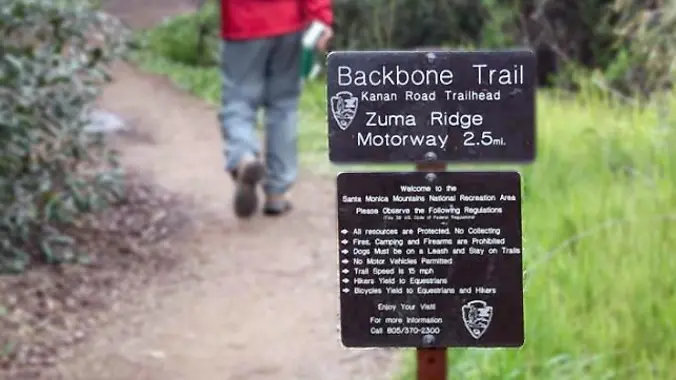
    http://photos1.meetupstatic.com/photos/event/b/a/2/4/event_99467652.jpeg Hoping the trail will dry out a bit. The waterfall should be flowing. From the Kanan Rd trailhead, we'll jump on the Backbone Trail for a cruise down into Newton Canyon. On our way there, we'll cross the creek, pass under an oak canopy, and come out into an opening. At the opening, look […]

  • Triunfo to White Horse Loop – Intermediate Hike

    Triunfo Community Park 1935 Tamarack St, Thousand Oaks, CA, US

    This hike circles the trails between South Ranch and Conejo Ridge. The conditions are ideal for this 6 mile (1000 foot elevation gain) lollipop. As of Tuesday, the trails were well drained (NOT muddy) with panoramic views of Conejo Valley (Ladyface Mtn, Las Virgenes Reservoir, Lake Sherwood). We will start at the trailhead at Triunfo […]

  • Intermediate Hike ~ Palo Comado / Cheseboro Loop via Ranch Center trail

    Trailhead Sunnycrest and Doubletree, Oak Park, CA, US

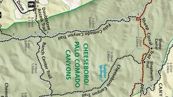
    This week we’ll do a loop around the northeastern regions of the Santa Monica Mountains National Recreation Area and the Las Virgenes Open Space. This area traverses many ecosystems, including riparian, chaparral, and the rockscape from Galaxy Quest. The area is generally dry, but very nice! http://photos1.meetupstatic.com/photos/event/c/3/0/c/event_255709932.jpeg The trailhead is where Sunnycrest turns into Doubletree, […]

  • Hill Canyon Santa Rosa Regional Park

    Hill Canyon Trailhead 10241 Hill Canyon Road, Camarillo, CA, US

    A second hike for Tuesday, this will be a bit slower. We will start at the parking area in Hill Canyon, cross the bridge over the runoff creek, and stroll a mile before turning onto the fire road up the Western Plateau. We will go straight at the crest of the fire road and then […]

  • Lynnmere Loop from Camino Magenta – a Gentler (not Beginner) Hike

    Camino Magenta Lynnmere Trailhead 1553 Camino Magenta, Thousand Oaks, CA, US

    Instead of our usual starting point at the Conejo Playfields, this shorter, gentler hike will start at the top of Camino Magenta, in the beautiful unincorporated Lynn Ranch neighborhood surrounded by Thousand Oaks. We'll do a clockwise loop around the gated Lynnmere community and wind up back at our starting point about 5 miles and […]


Trail statistics are approximate. For safety purposes always assume they are underestimated. But don’t be disappointed if they are overestimated. Bring more water and snacks than you think you’ll need.

Trail descriptions are based on previous hikes. Current conditions are unknown until arrival. Expect the unexpected and plan accordingly.

The Organizers and members of Hiking With Dean are not professional leaders, guides, or mountaineers. The function of the member or organizer is only to organize the trip. Each person who shows up for a trip/meetup (and their guest or guests) is responsible for his or her own safety. By attending a hike, or any other event organized by this group, you are acknowledging that you and any guests that you bring are aware of the risks, dangers and hazards associated with the activity and freely accept and fully assume all such risks, dangers and hazards, and further agree to release and discharge the Organizers, Members of the Hiking With Dean Meetup Group from and against any and all liability arising from your participation in the group activities per our ASSUMPTION OF RISK AND LIABILITY WAIVER and Section 6.2 of the Meetup.com Terms of Service.