• Rosewood Trail: Lynn to Angel Vista – Gentler Intermediate

    Regal Oak Court & Lynn Road Thousand Oaks, CA, US

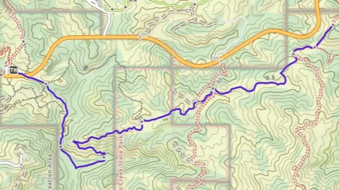
    Meet at the Rosewood sign, which is at the Regal Oak Ct. and Lynn Rd. intersection. The hike is about 5 miles with an elevation gain/loss approximately 900’. We'll walk a short distance on Lynn road to the lower Rosewood Trail, then take the dirt trail up a shaded ravine and continue on the Rosewood […]

  • Encinal to Big Tree and Back – Zuma Canyon Gentler Hike

    Backbone Trail - Encinal Canyon Trailhead Encinal Canyon Rd, Malibu, CA, US

    This out-and-back hike on the Backbone Trail is about 5 miles with about 1,200' of total elevation gain. The hike starts and ends at our usual trailhead for the Encinal Canyon hike. We'll cross the road, descend into a shaded single-track trail with a couple of lovely small water crossings, then ascend until we get […]

  • Canyon Overlook Trail to Lizard Rock – Intermediate Gentler

    Hill Canyon Trailhead Hill Canyon Rd, Camarillo, CA, US

    I pre-hiked this route on Friday as the weather is getting hot and I haven’t hiked the Canyon Overlook Trail for quite a while. It was pretty exposed, but the ocean breeze made it comfortable. The hike starts at the parking area on Hill Canyon Road and climbs Canyon Overlook Trail. The trail is a […]

  • 7 miles~ Los Robles Trail West ~ Intermediate Hike

    Los Robles Open Space Trailhead S Moorpark Rd, Thousand Oaks, CA, US

    http://photos1.meetupstatic.com/photos/event/b/f/8/6/event_22189030.jpeg Space Mountain is the name for Los Robles Trail West, starting at Moorpark Road in Thousand Oaks and switchbacking up the hill to the west. No one seems to know why it's called Space Mountain, though maybe the Disney ride inspired the name. We'll hike up towards Angel Vista but we’ll retrace our steps […]

  • Rosewood Trail: Lynn to Angel Vista – Gentler Intermediate

    Regal Oak Court & Lynn Road Thousand Oaks, CA, US

    Meet at the Rosewood sign, which is at the Regal Oak Ct. and Lynn Rd. intersection. The hike is about 5 miles with an elevation gain/loss approximately 900’. We'll walk a short distance on Lynn road to the lower Rosewood Trail, then take the dirt trail up a shaded ravine and continue on the Rosewood […]

  • Boney Mountain Hike (Fast Paced)

    Rancho Sierra Vista/Satwiwa Wendy Trailhead Potrero Rd & S Wendy Dr, Newbury Park, CA, US

    Please read these restrictions before signing up. Don't show up unless you're shown on the "Attending" list Unregistered or waitlisted will be turned away No "Plus Ones" on this hike We will go to our overlook on Boney for a beautiful 360 degree viewpoint. We will have a good time hiking through the area and […]

  • Gentler Intermediate Southern Wildwood

    Wildwood Park West Avenida De Los Arboles, Thousand Oaks, CA, United States

    PLEASE NOTE THE EARLIER START TIME 8:30 AM OUR ROUTE : We will be leaving from the main parking lot on Ave. de Los Arboles, going west to Stagecoach Bluff, circle around the backside of Lizard Rock, along the ridge and down the switchbacks to the Hill Canyon Trailhead. We'll then cross the foot bridge […]

  • Rancho Sierra Vista/Satwiwa trail loops hike ~ Gentler Intermediate

    Rancho Sierra Vista/Satwiwa 4121 Potrero Rd, Newbury Park, CA, US

    This hike will be an 8-figure of two loops starting at the Satwiwa Loop Trail from the parking lot. Then, we will continue hiking the South Ridge Trail on the other side and back to the parking lot through the Ranch Overlook Trail. "Satwiwa" is Chumashan and directly translates to "the bluffs," which can also […]

  • Ride the Two Winds from Mountain Creek Dr – intermediate hike

    Mountain Creek Drive Mountain Creek Dr, Thousand Oaks, CA, US

    UPDATE: Please review our guidelines to participate in our hikes. Here are some highlights and a link to the guidelines: https://www.meetup.com/The-Weekday-Trailblazers/about/ Restrictions apply for your safety and ours: Don't show up unless you're on the "Attending" list No "Plus Ones" on this hike Plan on completing the entire hike at a reasonable pace or please […]


Trail statistics are approximate. For safety purposes always assume they are underestimated. But don’t be disappointed if they are overestimated. Bring more water and snacks than you think you’ll need.

Trail descriptions are based on previous hikes. Current conditions are unknown until arrival. Expect the unexpected and plan accordingly.

The Organizers and members of Hiking With Dean are not professional leaders, guides, or mountaineers. The function of the member or organizer is only to organize the trip. Each person who shows up for a trip/meetup (and their guest or guests) is responsible for his or her own safety. By attending a hike, or any other event organized by this group, you are acknowledging that you and any guests that you bring are aware of the risks, dangers and hazards associated with the activity and freely accept and fully assume all such risks, dangers and hazards, and further agree to release and discharge the Organizers, Members of the Hiking With Dean Meetup Group from and against any and all liability arising from your participation in the group activities per our ASSUMPTION OF RISK AND LIABILITY WAIVER and Section 6.2 of the Meetup.com Terms of Service.