Site Search

Trail Mix

Hike to the Brown Mountain Dam Waterfall – Gabrieleno Trail

JPL Riparian Zone Explorer Rd, Altadena, CA, US

This hike is so cool! It's a good distance with little elevation gain and it is beautiful. This hike will take us to the Brown Mountain Dam Waterfall. The hike is an out and back at around 8 miles total with 750 ft. of elevation gain, so not steep! This area of the Angeles National […]

Afternoon Hike at Whiting Ranch (Dreaded Hill!) – Wahoo’s Parking Lot

Wahoo's Fish Taco 27412 Portola Parkway, Foothill Ranch, CA, US

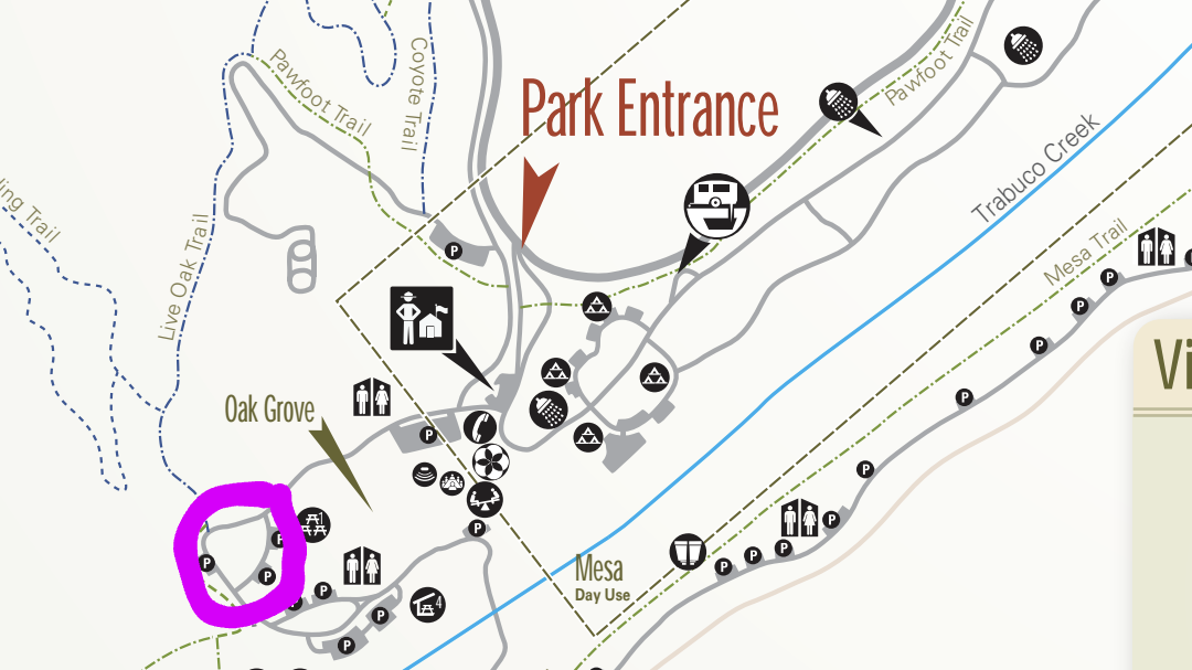
This hike will be about 5 miles total with 850 ft. of elevation gain. We are starting at the parking lot at the Wahoo's parking lot. We will take Live Oak Trail. This turns into Serrano Road which will take us to Dreaded Hill. We will take a short break at Four Corners. Then we […]

Hike at Caspers Wilderness Park – Bell Canyon + Oso Trail

Caspers Wilderness Park 33401 Ortega Hwy, San Juan Capistrano, CA, US

The hike I am planning is around 6.3 miles with about 700 ft. of elevation gain. It starts at the very end of the paved road, the long gray strip that can be seen on the map. We will begin at the Bell Canyon Trail head. We will continue onto that and then take it […]

Hike to the Brown Mountain Dam Waterfall – Gabrieleno Trail

JPL Riparian Zone Explorer Rd, Altadena, CA, US

This hike is so cool! It's a good distance with little elevation gain and it is beautiful. This hike will take us to the Brown Mountain Dam Waterfall. The hike is an out and back at around 8 miles total with 750 ft. of elevation gain, so not steep! This area of the Angeles National […]

Afternoon Hike at Bommer Ridge into Laguna Coast Wilderness – Loop

Crystal Cove SP/Laguna Coast - Ridge Park Entrance (map) Ridge Park Rd & E Coastal Peak, Newport Beach, CA, US

The total distance for this hike is 4.5 miles with about 650 ft. of elevation gain. There are great mountain and ocean views along the ridge. We are going to start on Bommer Ridge Trail and take this to Lizard Trail. We will go down that and loop back up to Bommer via Upper Laurel. […]

Hike at Newport Back Bay

Upper Newport Bay Nature Preserve 2301 University Dr, Newport Beach, CA, US

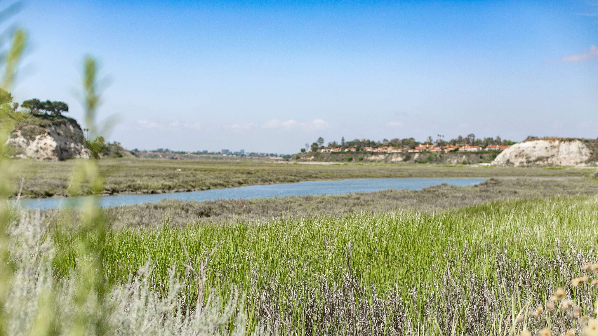
Let's hike at the Back Bay in Newport. We will be doing about 5 miles. It will be an out and back. A lot of the trail is asphalt. You can wear hiking or running shoes. There is a Upper Newport Back Bay Nature Preserve parking lot right off University Dr. and Irvine Ave. (See […]

Exploring Caves – Hike at Aliso and Wood Canyons Park

Canyon View Staging Area 22124 Utility Access, Aliso Viejo, CA, US

We are going to be starting at the Canyon View Staging Area. This hike is roughly 7 miles with relatively low elevation gain. The expectation is to definitely make it to Cave Rock and Dripping Cave. Hopefully we see animals too! Link to Parking from Google Maps: https://www.google.com/maps/place/Canyon+View+Staging+Area/@33.585273,-117.7465062,17z/data=!3m1!4b1!4m5!3m4!1s0x80dce61b6bd45c2d:0x5ef3f1ad687cc8b5!8m2!3d33.585273!4d-117.7443175 Dogs are not allowed at this park. […]

Wilderness Access Day – Gypsum Canyon Wilderness

Gypsum Canyon Wilderness South Gypsum Canyon Road 390, Yorba Linda, CA, United States

Additional registration is not required for the event. Details about the event: https://letsgooutside.org/activities/2025/06/14/wilderness-access-day-gypsum-canyon-wilderness-25/ Please join us for our second exploratory hike at Gypsum Canyon! We plan to do 4-5 miles with roughly 800 ft. of elevation gain. Located within OC Parks’ Irvine Ranch Open Space, Gypsum Canyon Wilderness features seven new trails for hiking, mountain […]

Hike at Peter’s Canyon Regional Park – Big Red & Around the Reservoir

Peter Canyon Regional Park 8548 E Canyon View Ave, Orange, CA, US

The hike will be about 5.7 miles with about 750 ft. of elevation gain. We will start on Peters Canyon Trail and take this to East Ridge View Trail. This is where we will go up Big Red. Then we will continue on this trail until we get to Eucalyptus to loop back. We will […]

[asa2_collection tpl=”Flex_1″ orderby=”rand” limit=”4″]2[/asa2_collection]

Trail statistics are approximate. For safety purposes always assume they are underestimated. But don’t be disappointed if they are overestimated. Bring more water and snacks than you think you’ll need.

Trail descriptions are based on previous hikes. Current conditions are unknown until arrival. Expect the unexpected and plan accordingly.

The Organizers and members of Hiking With Dean are not professional leaders, guides, or mountaineers. The function of the member or organizer is only to organize the trip. Each person who shows up for a trip/meetup (and their guest or guests) is responsible for his or her own safety. By attending a hike, or any other event organized by this group, you are acknowledging that you and any guests that you bring are aware of the risks, dangers and hazards associated with the activity and freely accept and fully assume all such risks, dangers and hazards, and further agree to release and discharge the Organizers, Members of the Hiking With Dean Meetup Group from and against any and all liability arising from your participation in the group activities per our ASSUMPTION OF RISK AND LIABILITY WAIVER and Section 6.2 of the Meetup.com Terms of Service.