Site Search

Valencia Hiking Crew

Inspiring/Challenging/Steep Moonlight Hike: Caballero Lp Trl off Reseda(Tarzana)

4047 Reseda Blvd 4047 Reseda Blvd, Tarzana, CA, US

STATS Difficulty: 5/10, Moderate but steep uphill Length: 4 miles, 2 hours plus breaks Elevation Gain & Loss: 1400’ View: Cross-valley view and Ocean on clear nights Details: Steeper uphill, easier downhill TRAILHEAD INFO Park on the street near the address. Night-hiking in LA is amazing! Trails are practically empty, breeze is cool, & the […]

Strawberry Scramble Loop via Colby Canyon

Colby Canyon Trailhead 701 Angeles Crest Hwy, Tujunga, CA, US

Scramble lovers only. We're taking the mountaineers route with about a mile of exposed climbing on the rocks. Limiting to those I'm comfortable climbing with since it will be a full hike and a long day. STATS Distance: ~12 miles Elevation: >3200 Level: 8/10 Duration: 6+ hours, bring snacks and/or lunch NOT FOR BEGINNERS! NO […]

Inspiring & Challenging Steep Moonlight Hike to Parker Mesa Overlook

468 S Surfview Dr 468 S Surfview Dr, Pacific Palisades, CA, US

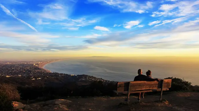
STATS Difficulty: 4/10, Moderate but steep uphill Length: 2.5 miles, 1.75 hours plus breaks Elevation Gain & Loss: 1200’; Peak: 1523’ View: Panoramic view of Malibu, ocean, West Side, Downtown Details: This hike has some STEEP moments, is not on most trail maps & has 2 benches on top to relax on TRAILHEAD INFO The […]

Scramble Loop to Camelback from Haines Canyon

Haines Canyon Los Angeles, CA, US

I like finding hikes close to home that aren't always on other people's radar. This is the best description of the hike to "Mount Camelback" I've found: Officially, as far as I've seen on any map, there is no such place. The Sunland US Topo map does not list this mountain. Really it's more part […]

Challenging Steep 1/4-Moon Night Hike:Teepee Loop off of Mt. Lukens Truck Trail

Parking Lot at Angeles Crest Hwy & Mt Lukens Truck Trail Angeles Crest Hwy & Mt Lukens Truck Trail, La Cañada Flintridge, ca, US

**STATS** Difficulty: 4/10, Moderate but steep uphill Length: 3.2 miles, 1.5 hours plus breaks Elevation gain and loss: 1,150 Ft View: Mountains & City Lights Details: Steep uphill, great view from midpoint & easy downhill on road **TRAILHEAD INFO** CA-2, La Cañada Flintridge, CA 91011 Getting there might be tricky so please review the "How […]

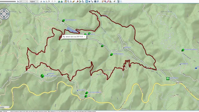
Jackson Lake Loop (Courtesy of Paul Taylor)

Jackson Lake Picnic Site Valyermo, CA, US

This is a beautiful loop hike through the pines just north of the Angeles Crest Hwy, East of Vincent Gap, and West of the Big Pines Hwy Junction. The hike begins at the Jackson Lake picnic area and quickly ascends as it heads southwesterly towards the PCT, then east paralleling the old paved Grassy Hollow […]

Dragon’s Back Scramble to Cathedral, Arlington and La Cumbre

Inspiration Point Trailhead Spyglass Ridge Rd, Santa Barbara, CA, US

Scramble lovers only! This one has been on my list for a while. Full disclosure - I have not done this route before. There are different options on the scramble up so we will look for the one that best suits the group. Limiting to those I'm comfortable climbing with since it will be a […]

Inspiring, Challenging & Fun: Steep Moonlight Night Hike: La Tuna Hostetter Loop

South La Tuna Canyon Road S La Tuna Canyon Rd, Los Angeles, CA, US

**STATS** Difficulty: 5/10, Moderate but steep uphill, fire road return Length: 4.2 miles, 2.5 hours plus breaks Elevation gain and loss: 1,630 Ft View: Mountains & City Lights Details: Steep uphill, great view from midpoint & optional easy downhill on road **TRAILHEAD INFO** S La Tuna Canyon Rd, Sun Valley, CA 91352 Getting there might […]

Santa Cruz Island Camping v6-Cinco de Mayo-ish Weekend 2022

Channel Islands National Park 1901 Spinnaker Dr, Ventura, CA, US

*TRIP SUMMARY*This, the 6th Cinco de Mayo-ish Weekend at Santa Cruz Island, will again be a 3 day/2 night joint outing of the VHC and my NoCal group the Monterey Bay Area Hiking Group (MBAHG). The total group size (including MBAHGers and VHCers) will be limited to ~22 total. Cost per person is $10.00 to […]


Trail statistics are approximate. For safety purposes always assume they are underestimated. But don’t be disappointed if they are overestimated. Bring more water and snacks than you think you’ll need.

Trail descriptions are based on previous hikes. Current conditions are unknown until arrival. Expect the unexpected and plan accordingly.

The Organizers and members of Hiking With Dean are not professional leaders, guides, or mountaineers. The function of the member or organizer is only to organize the trip. Each person who shows up for a trip/meetup (and their guest or guests) is responsible for his or her own safety. By attending a hike, or any other event organized by this group, you are acknowledging that you and any guests that you bring are aware of the risks, dangers and hazards associated with the activity and freely accept and fully assume all such risks, dangers and hazards, and further agree to release and discharge the Organizers, Members of the Hiking With Dean Meetup Group from and against any and all liability arising from your participation in the group activities per our ASSUMPTION OF RISK AND LIABILITY WAIVER and Section 6.2 of the Meetup.com Terms of Service.