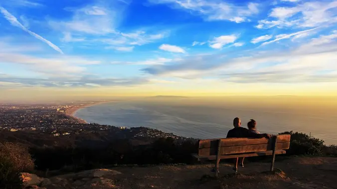
**STATS** Difficulty: 4/10, Steep up & down, with some slippery spots Length: 3 miles, 2 hours plus breaks Elevation Gain & Loss: 1225’; Peak: 2700’ View: Amazing 360 View of Valleys and Mountains Details: This hike has some STEEP moments but has a bench at the top to relax on. We made a new uphill […]
Early posting, need to be home by 3pm. The hike is waitlisted. Put yourself on the list and I will add you if I feel you can complete the hike at my pace safely Distance: 9 Elevation Gain: 2100 Rating: Intermediate/Advanced 7-10 Trail: Fire road, single track, class 1,2 rock climbs and some street crossings. […]
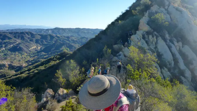
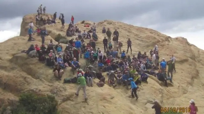
*Waitlisted. Hike will be at "beat the heat!" pace. Put yourself on the list and I will add you if I feel you can complete at the group's pace safely. Distance: <8 Out- and- back Elevation Gain: 1750 Rating: 5/10 Not for beginners, no sweeper Don's write up Eagle Rock, located in Topanga SP, is […]
**STATS** Difficulty: 4/10, Moderate but steep uphill Length: 3.2 miles, 1.5 hours plus breaks Elevation gain and loss: 1,150 Ft View: Mountains & City Lights Details: Steep uphill, great view from midpoint & easy downhill on road **TRAILHEAD INFO** CA-2, La Cañada Flintridge, CA 91011 Getting there might be tricky so please review the "How […]
This is another "beat the heat" pace hike, not for beginners. Trail is well maintained, shaded and cooler in the canyon. Distance: <7 Elevation Gain: we will find out Directions: On the 210 Freeway from La Canada/Hwy 2, take the Arroyo/Windsor exit and head north (left). Make an immediate right on Woodbury Rd. Make a […]
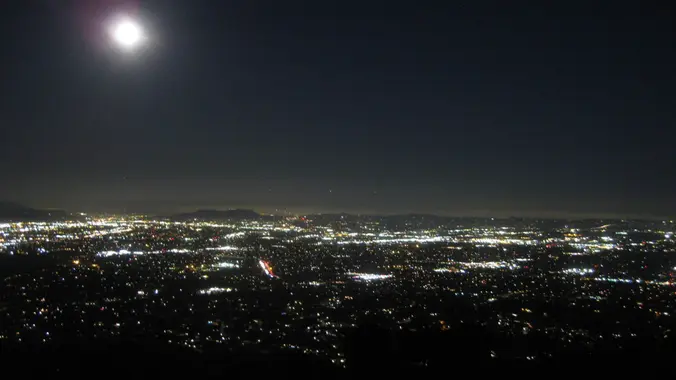
STATS Difficulty: 4/10, Moderate but steep uphill Length: 2.5 miles, 1.75 hours plus breaks Elevation Gain & Loss: 1200’; Peak: 1523’ View: Panoramic view of Malibu, ocean, West Side, Downtown Details: This hike has some STEEP moments, is not on most trail maps & has 2 benches on top to relax on TRAILHEAD INFO The […]
Description: This is a 3-night backpacking trip. The plan: The scheduled dates for this event is still tentative. The dates will be fixed once I get the wilderness permit from the INF. Considering that we already went through Gem Lake, let's see if it's feasible to start the trek from Agnew Meadow. Otherwise, we will […]
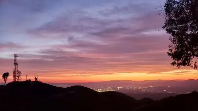
STATS Difficulty: 5/10, Moderate but steep uphill, fire road return Length: 4.2 miles, 2.5 hours plus breaks Elevation gain and loss: 1,630 Ft View: Mountains & City Lights Details: Steep uphill, great view from midpoint & optional easy downhill on road TRAILHEAD INFO S La Tuna Canyon Rd, Sun Valley, CA 91352 Getting there might […]
Needed an easy-ish hike to stretch the legs and get some fresh air. The weather should be a bit cooler and the trail is partially shaded. Water crossings may or may not be avoidable and we may or may not make a bushwhacky detour to a likely dry waterfall. IF the parking lot is closed, […]
Trail statistics are approximate. For safety purposes always assume they are underestimated. But don’t be disappointed if they are overestimated. Bring more water and snacks than you think you’ll need.
Trail descriptions are based on previous hikes. Current conditions are unknown until arrival. Expect the unexpected and plan accordingly.
The Organizers and members of Hiking With Dean are not professional leaders, guides, or mountaineers. The function of the member or organizer is only to organize the trip. Each person who shows up for a trip/meetup (and their guest or guests) is responsible for his or her own safety. By attending a hike, or any other event organized by this group, you are acknowledging that you and any guests that you bring are aware of the risks, dangers and hazards associated with the activity and freely accept and fully assume all such risks, dangers and hazards, and further agree to release and discharge the Organizers, Members of the Hiking With Dean Meetup Group from and against any and all liability arising from your participation in the group activities per our ASSUMPTION OF RISK AND LIABILITY WAIVER and Section 6.2 of the Meetup.com Terms of Service.


Recent Comments