

This used to be a 4-mile snow hike to Mr. Pinos hosted by Don T during the winter season. But I’m hosting it as a Spring conditioning hike, which is also posted by VHC hiker Kim who’s hosting it in another hiking group. Just in case her group cancels due to cold weather, I’m still going. Summer is just around the corner. And per recent Alltrails May 2021 trail reports, microspikes and snow shoes are no longer required.
Start time is 12:30 p.m. Please allow yourself time, get there at 12:00 noon and bring layers. We will be on the trail by 12:30 p.m.
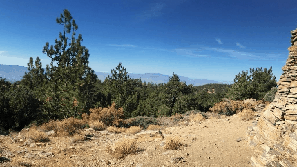
Trail, wide open road and easy to navigate
WHAT: Afternoon hike. Flexible distance.
WHERE: Mt. Pinos, Los Padres Nat Forest
Mount Pinos (8,831ft.) is the highest point in the entire Los Padres National Forest, our state’s largest national forest. The Los Padres’ pristine, wind-swept beaches, wild rivers and canyons, oak-studded coastal mountains and thickly forested alpine regions form a microcosm of the beautiful landscapes California has become known throughout the world for. Indeed, Mount Pinos is a special place. It is crowned with a rich forest of white and noble fir, ponderosa and Jeffrey pine, as well as, lodgepole and limber pine near the summit. Pinos is one of Southern California’s premiere destinations for cross-country skiing and snowshoeing because of its rolling, open terrain, excellent snow and lovely views. Add the factor of easy, paved road access to the trailhead parking lot at 8,300 feet, and you can see why Mount Pinos is so popular with alpine enthusiasts. In less than an hour, you can be standing on top of a mountain that is nearly 9,000 feet tall with panoramic views of the Central Valley, the Southern Sierra, the Tehachipi mountains and the San Gabriels’. Even the shimmering Pacific and the distant Channel Islands can be seen on a clear day! This is a great place to take in the enormity and diversity of the Southern California landscape.
MILEAGE: 10.3 miles maximum. But hikers may turn back upon reaching Mt. Pinos (3.6 miles), Sawmill Mountain or Grouse Mountain. (See detailed map in the Photos tab)
ABILITY: Advanced Beginners to Advanced -everyone is welcome!
DETAILS: If you hike or exercise and consider yourself an advanced beginner, you will be just fine on this trip. Park your car at the road-end parking lot on the Mount Pinos Rd. There is a considerable climb on this hike going to Sawmill Mountain. If at anytime you are wishing to take a break, are feeling light-headed or thirsty, know your limits. You can head back or find a spot to rest. As always, know your own capabilities and be prepared for an adventurous, exploratory outing. We are only organizers, and are not held responsible or liable.
WHAT TO BRING: Layers for the upper body-so you can strip, synthetics so you are dry, hats, sunglasses, or goggles, gloves, etc….. Sunblock and lip block at this altitude is very important! Also bring food and snacks for the trail & lunch, plenty of water, and CAMERA! Extra change of clothes for after, kept in your car – makes the ride back much more cozy.
DIRECTIONS: From Los Angeles, take I-5 north over the Tejon Summit to the Frazier Park exit. Turn left at the freeway stop, onto Frazier Mountain Park Road. Head north passing the town of Frazier Park and follow the road 7 miles to Lake of the Woods. Continue straight onto Cuddy Valley Road and continue on Cuddy Valley/Mount Pinos Highway approx 4 miles until McGill campground(snow gate), and about another 4 miles to the end of the road at Chula Vista campground. Dead-ends at the Nordic Hut parking area, which is about 15-20 miles up the road from the I-5 freeway. Park here – – Meeting area.
**Please note the driving time it will take to arrive to the meeting spot/trail head. Be cautious on these roads, consider carpooling. You will not need a 4×4 unless we get hit by a major storm From the I-5 to the campground is about 25 minutes – – please give yourself plenty of time…get there a little early and play in the snow!
**Adventure passes are required for parking anywhere on the mountain. **Carpooling is strongly encouraged!
Click Me for more info on the area (http://www.frazierparkinfo.com/visit/sports_recreation.aspx#Hiking_Biking_Horseback_Riding)
*******************************************************************
The Fine Print
PLEASE – Know your limits and abilities. Bring snacks and drink plenty of liquids when hiking. Check weather conditions and dress accordingly and be aware of your surroundings at all times. Watching out for poison oak, snakes, ticks, uneven footing, spectacular views, beautiful fauna all while interacting with awesome (usually) fellow hikers can be extremely hazardous, rewarding and fun.
The Farzan Rule: Posted hike times are the time the hike starts or we leave from a posted shuttle location. I’m aware other Meetup groups offer a grace period for late arrivals; we don’t. It’s your responsibility to know the location of the meeting spot and be there and ready to participate at the posted time. If you have any concerns about the directions feel free to contact the organizer of the event, preferably in advance of the event and not at the start time. I’m of the opinion that it’s not fair to delay an event when the majority of attendees have arrived on-time. (so named after a conversation I had with a certain un-named member)
RSVP’s: If you RSVP for an event be responsible and update your RSVP if your plans change. If your plans change at the last second and you’re not able to update your RSVP also let us know. In my opinion a no-show is someone who has no regard for following the guidelines we request from our members and will risk being removed from future events that have a limit.
VHC HIKE RATING SCALE
Rating a hike is subjective, meaning the difficulty of a hike will be in direct relation to how often you hike and the type of hike you prefer. Keep in mind that any hike can have the following: un-even hiking surfaces, various obstructions, water and/or water crossings or bouldering and/or rock hopping. A great hike will have all of these!
1 – A long walk
2 – 4 mile hike w/little elevation gain
3 – 5 mile hike w/up to1000 ft. elevation gain
4 – 5+ mile hike w/up to1500 ft. elevation gain (heart rate increases at times)
5 – 7+ mile hike w/over 1500 ft. elevation gain (heart rate increasing even more at times)
6 – 7+ mile hike w/over 2000 ft. elevation gain (at times you might be trying to remember how to perform CPR)
7 – 5+ mile hike w/over 2000 ft. elevation gain (at times you might be muttering expletives to yourself)
8 – 10+ mile hike w/over 3500 ft. elevation gain (at times you might be angry with the hike leader)
9 – 10+ mile hike w/over 5000 ft. elevation gain (at times you might be thinking of reporting the hike leader to the authorities)
10 – Use your imagination
Class 3 Scrambling: Scrambling or un-roped climbing. You must use your hands at times to hold the terrain or find your route. This may be caused by a combination of boulders, steepness and extreme terrain. Some Class 3 routes have ropes in place for assistance.
DISCLAIMER / RELEASE OF LIABILITY
IMPORTANT, PLEASE READ BELOW IN ITS ENTIRETY:
I am a volunteer (i.e. not liable for the group). Safety is a priority for everyone in the group. Think of this as hiking with a group of friends.
Outdoor events can be inherently dangerous and accidents may happen. By participating in any posted event, you’re taking responsibility for your own safety and well-being. The VHC Meetup Group and its organizers are not trained leaders and we do not confirm the qualifications of any of its members to lead or participate in trips. All participants take full responsibility for their own actions. If you choose to sign up for any VHC Meetup events, you are releasing the VHC Meetup Group and it’s organizers from all liability in case of possible injuries as stated in paragraph 6.2 of the Meetup “Terms of Service” located on the bottom of the Meetup website. Your personal safety depends on your own judgment and experience.


