

BEFORE YOU WILL BE MOVED TO THE GOING LIST, YOU WILL NEED TO UPDATE YOUR CDH PROFILE (The three questions must be answered with a “yes”) IF YOU HAVE NOT ALREADY DONE SO.
NEED HELP:
[[go to: https://wp.me/P9MbG4-hC](go to: https://wp.me/P9MbG4-hC)](http://%5Bgo%20to:%20https//wp.me/P9MbG4-hC%5D(go%20to:%20https://wp.me/P9MbG4-hC))
Our Wednesday Trekkers know how to cool down on a hot day, so we’ll do just that as the temps scare off others. I will take the group in for some cooling off fun in Little Rock Creek. The first two peaks are very easy to bag and that will be done early in the hike before it gets too warm. After that, we’ll be dropping down a ridge all the way to Little Rock Creek as the heat builds up and hopefully we’ll find a pool deep enough to submerge in. The water is one of the coolest in the San Gabriel Mountains. After a long cool break in the Creek we’ll take the last 1.75 miles on the Burkhart Trail as it goes up to the Car or cars dropped off at The Buckhorn Campground. Total miles will be 8 miles with a 1500′ gain and a 2000′ loss in elevation. As we drop down to just a 100′ above the creek the going gets a bit steep which will require using your hands to assist in the descent. Micro spikes will help here.
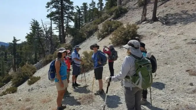
Join me and experience the thrill of cross country hiking in the high country of the San Gabriel Mountains as we bag two peaks on the Sierra Club’s 100 peak list. The route we will be following this time has “use” trails, for the most part, which strong intermediate hikers will enjoy. The views along the way are spectacular and the idea of bagging some peaks along the way is a bonus.
This all day trek is for those of you who are looking for something a lot more challenging than the average outing. No beginners please unless you’re in top physical condition. Cross country hiking experience would help for this. If you have some place to be later in the day, this event will not work for you.
We will be setting a steady pace with several breaks while staying together all the way so as not to loose anyone.
DURATION: We’ll want to finish the hike and be back to the cars by 3:00 p.m. at the latest, followed by lunch at The Habit Burger Grill in La Canada.
DAY’S AGENDA
START: Once we all arrive at Cloudburst Summit (7034′) at mile marker (LA 57.10), we’ll first drop off a car or cars at the Burkhart trailhead before taking on the 1st PEAK.
1st PEAK: Winston Peak at 7502′ will be our highest elevation along this planned route, and it will be bagged before heading out along THE RIDGE.
THE RIDGE: Winston Ridge (7003′) offers distinct continuous views over desert and high mountain country as well as overlooking THE CREEK below.
THE CREEK: Little Rock Creek is a desert bound creek fed by the springs high in the granite folds of Mt. Williamson. We will cross this beautiful creek at its 5640′ elevation point and enjoy a pool and COOPER CANYON FALLS.
COOPER CANYON FALLS: “**Cooper Canyon Falls** is a beautiful waterfall that flows almost year round, but roars in April-May as the spring snow melts.” *Socalhiker*
It’s here where the WWW will most likely take their revenge out on me in an all out water fight before heading out on an uphill 1.75 mile hike in heat to Buckhorn Campground to finish the hike. PACK THOSE WATER GUNS!
EARLIER MEETUP LOCATION AND TIME: 6:30am at the Woodland Hills Meetup location. Those who want to carpool from Woodland Hills, can meet me at the corner of Leonora and Ponce Avenue. Ponce is the first street east of Fallbrook. We can park on Ponce which is not in front of any houses.
IF MEETING HERE, LET ME KNOW, OTHERWISE I WON’T BE STOPPING THERE.
SEE MAP SITE BELOW
[https://www.google.com/maps/place/34%C2%B010’04.0%22N+118%C2%B037’16.0%22W/@34.1677751,-118.6216512,228m/data=!3m2!1e3!4b1!4m6!3m5!1s0x0:0x0!7e2!8m2!3d34.1677741!4d-118.6211043](https://www.google.com/maps/place/34%C2%B010’04.0%22N+118%C2%B037’16.0%22W/@34.1677751,-118.6216512,228m/data=!3m2!1e3!4b1!4m6!3m5!1s0x0:0x0!7e2!8m2!3d34.1677741!4d-118.6211043)
MEETUP LOCATION AND TIME: 7:30 am at the meetup location on Hwy. 2 in La Canada. (BOOTS ON, READY TO GO).
IF MEETING THE GROUP HERE, YOU MUST STATE SO, OTHERWISE I WON’T BE STOPPING HERE.
MEETUP DIRECTIONS: From the 210 Fwy, exit at Angeles Crest Hwy and drive north about a quarter mile to just past Milmada Dr. in LA CANADA, then park alongside the road. We will all meet here no later than 7:30 a.m. and take as few cars as possible to Three Points Summit.
[https://www.google.com/maps/place/Three+Points+Trailhead/@34.3398586,-117.9997747,14z/data=!4m5!3m4!1s0x80c2e3a2211068bf:0xb78ddf64f081d3fc!8m2!3d34.343403!4d-117.9827788](https://www.google.com/maps/place/Three+Points+Trailhead/@34.3398586,-117.9997747,14z/data=!4m5!3m4!1s0x80c2e3a2211068bf:0xb78ddf64f081d3fc!8m2!3d34.343403!4d-117.9827788)
DURATION: All day – DON’T HAVE OTHER COMMITMENTS LATER THAT DAY
TERRAIN: Well defined “use” trail along ridges which can be very steep at times.
DISTANCE: 5.6 miles
ELEVATION GAIN/LOSS: 1500’/2000′
ELEVATION RANGE: 5600′ – 7500′
THE PACE: A comfortable pace no faster than the slowest hiker.
LEVEL: Strong Intermediate hiker with steep cross country experience.
DOGS ALLOWED: NO


