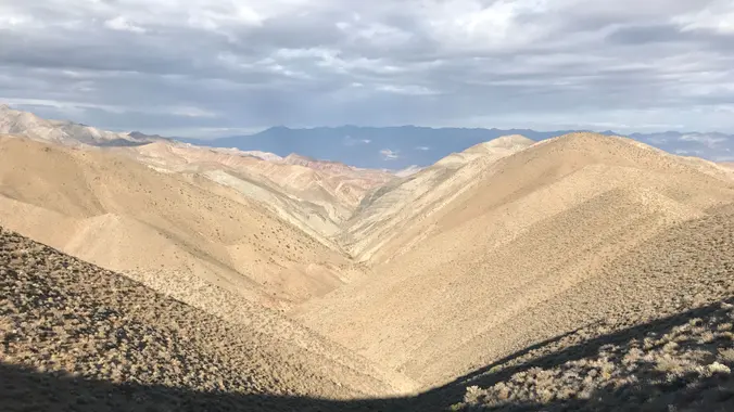
This is a great desert backpacking trip. One of only a few in Death Valley with water and the only loop that I know of. Mid-February should be a good chance to catch the wildflowers as well. Check out the photos from the last three trips:
Fall 2016 trip:
https://www.meetup.com/SanDiegoBackpackers/photos/235721845/
Fall 2017 trip:
https://www.meetup.com/sandiegobackpackers/photos/28397936/
Winter 2020 trip:
https://www.meetup.com/sandiegobackpackers/photos/30696504/
Copied from nps.gov (https://www.nps.gov/deva/planyourvisit/backpacking.htm)
Difficulty: Intermediate Backpacking Trip
Mileage: 16 miles
Elevation Gain/Loss: 1500’/3600′
Type of hike: walk dirt road; no trail; gravel wash and cross-country; some brushy areas.
Water: Seasonal springs in upper Cottonwood Canyon and Deadhorse Canyon.
Vehicle Needed: High clearance to get to canyon mouth. 4×4 to do shuttle.
Link to Map:
https://www.nps.gov/deva/planyourvisit/upload/Cottonwood-Marble-Canyon-Loop-Route-map.pdf
Day 0 (Friday): I plan on driving up Thursday night and doing other stuff in the park on Friday.
Saturday: Hopefully everyone will make it to our camp on Friday night or Saturday morning. There is no cellphone coverage in the canyon. We will leave one vehicle behind, pile everyone into the remaining vehicle(s) and head up to the end Cottonwood Canyon road.
Hike up Cottonwood Canyon and to Deadhorse spring to camp (9.5 miles).
Sunday:
Hike down Deadhorse Canyon to Marble Canyon back to the car (6.5 miles). There is an optional side hike up Marble canyon. Retrieve the vehicles from the end of Cottonwood Canyon road.
Miscellaneous
Doing this a couple weeks later than last time. It could be warm!
GPX (https://www.nps.gov/deva/planyourvisit/upload/Full-Cottonwood_Marble_VUA_Trip_2016.gpx)
NPS Description (https://www.nps.gov/deva/planyourvisit/upload/Cottonwood-Marble-Canyon-Route-Handout.pdf)
Offroad map (https://www.nps.gov/deva/planyourvisit/upload/Death-Valley-Backcountry-Roads.pdf)
Weather Report (http://forecast.weather.gov/MapClick.php?lon=-117.39276206005471&lat=36.544107374151466#.WDJP_DtzK-I)
DISCLAIMER: Hike at your own risk. Be responsible for yourself and your safety. Make good decisions. With any trip, things can change, reservations can get lost, the unexpected can happen. A go-with-the-flow attitude is always a good thing, and most importantly, let’s all have fun! This is a intermediate hike. Make sure you are in good enough physical shape for the distance, elevation changes, and terrain. The hike leaders in this group aren’t professional hike leaders. By signing up for these events, you agree not to hold the Meetup organizers responsible for whatever happens to you on these events. The hiking group does not certify the expertise of the organizers, the event or assistant organizers (hike leaders) and…We are NOT responsible for any possible losses or injuries.


