3 miles, 600′ gain, easy intermediate.
Easy option: 2.5 miles, 500′ gain, fit beginner.
The route is similar to the Beach Party hikes.
From the parking lot, we return to the main entrance road and walk about a quarter mile to the trailhead.
From the trailhead, we will hike 0.1 miles up the Sycamore Canyon Fire Road, where will turn left onto the Scenic Trail. Optionally, we may instead continue an additional 2000′ and turn left on the Overlook trail until it ends and then turn left onto the Scenic trail.
At the top of the Scenic Trail, we will make a sharp left (not an easy left) onto the Great Dune Vista Trail. This trail follows a ridge overlooking both the ocean and the canyon. We will continue along the ridge to the highest point, and then retrace our steps back to the top of the Scenic Trail. We then make the easy left that we previously avoided and proceed for 0.1 miles until the trail dead ends at the edge of the cliffs (Scenic Vista).
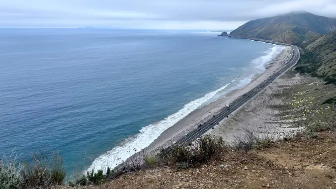
We will then have our social event at Scenic Vista, where we will share snacks and drinks. Scenic Vista is an incredible overlook of the ocean and the sand dune, as well as an unrivaled sunset viewing spot.
Easy Option: Skip the ridge and wait for the rest of us at Scenic Vista.
Finally, we will return along the ridge the way we came. We’ll turn right at the first junction along the Scenic trail back until it ends at Sycamore Canyon fire road, then right back to the trailhead. Please bring food and drink to share.
Hike (Route Link – shows optional Overlook trail)
Distance: 3 miles or 2.5 miles
Gain: 600 or 500
Distribution: The final 0.3 miles are fairly steep, but no hands required, otherwise well-distributed.
Difficulty: Easy intermediate or fit beginner.
Shape: Out and back, optionally upsidedown lollipop.
Pace: approx. 2.0 mph.
Trail Type: Mostly single-track and double-track.
Duration: 3.5 hrs.
Dogs: No.
Restrooms: Yes, at the trailhead.
Drinking Fountains: Yes, at the trailhead.
Parking (link)
Recommended parking is along the north side of the Pacific Coast Highway until 10p, in front of sand dune (parking is also available on the south side of the highway) 1/2 mile from the campground entrance. Pay attention to parking signs.
Alternate parking: Campground lot, $12 ($11 62+), gates close at 10p.
Meet at the campground parking lot entrance (link): From the sand dune on PCH, walk 1/2 mile to the campground entrance, enter the campground, turn left after the guard shack. Parking lot is left after that. We meet at the parking lot inside the campground (by the restrooms). We will walk to the trailhead from there.
What to bring: 1 liter of water for every 3 miles.
Hiking shoes/boots. Not required, but recommended.
Sunscreen, Hat.
Snacks and/or beverages to share
Navigation: Host memory, GPS.
Flashlight or headlamp. The return may be dark.
Directions
Pt. Mugu State Park
Main parking lot inside Sycamore Canyon Campground, across from Sycamore Cove beach.
Malibu, CA 90265
From CA-118
CA-118 West.
CA-23 South for 7.4 miles.
US-101 North for 10.8 miles.
Exit 53B Lewis Rd./CA-34.
Right (east) onto E. Daily Dr. for 0.1 miles.
Right (south) onto N. Lewis Rd. for 4.5 miles.
Becomes Hueneme Rd., continue for 0.9 miles.
Left on Las Posas Rd. for 3.1 miles.
Left on CA-1 for 5.9 miles.
From US-101
Exit 55, Las Posas Rd.
Las Posas Rd. south for 7.5 miles.
Left on CA-1 for 5.9 miles.
FAQ
Hiking Plus Page Links
Disclaimer / Release of Liability


