

This is Jerry Schad’s Indian Canyon / Borrego Palm Canyon Traverse.
Back in 2021 I made this a loop and it may have been a little bit too epic 🙂
(https://www.meetup.com/sandiegobackpackers/events/269364126/?eventOrigin=group_calendar)
This trip starts from third crossing. First night camp is Bennis Bowl. If you want to do a nice beginner trip you can join us for the first night. Or you can do the fun part and hike up Indian Canyon and down Borrego Palm Canyon. This is a car shuttle.
“This is a grand tour of one of Anza-Borrego’s most remote, rugged, and beautiful areas. In the midsection of this trip, you’ll pass through a pristine wilderness where the tracks of a mountain lion are far more common than the impressions of a lug-soled boot.”
Jerry Schad – Afoot and Afield: San Diego Country: A Comprehensive Hiking Guide
Difficulty: Strenuous Backpacking Trip
Type of hike: Difficult Class 3. Rugged cross country hiking. Streams, boulders, dry falls, brush, loose rock, etc.
This hike is a bit of a bushwhack. Long pants and long sleeves highly recommended! I will bring shears to trim cats claw 🙂
Day 1 (Saturday)
Meet at the corner of Montezuma Valley Road and Palm Canyon Dr.
33.25645, -116.39856
Shuttle to the closure of Coyote Canyon Rd.
33.36880, -116.42124
Distance: 5.6mi
Elevation Gain/Loss: 1100’/0′
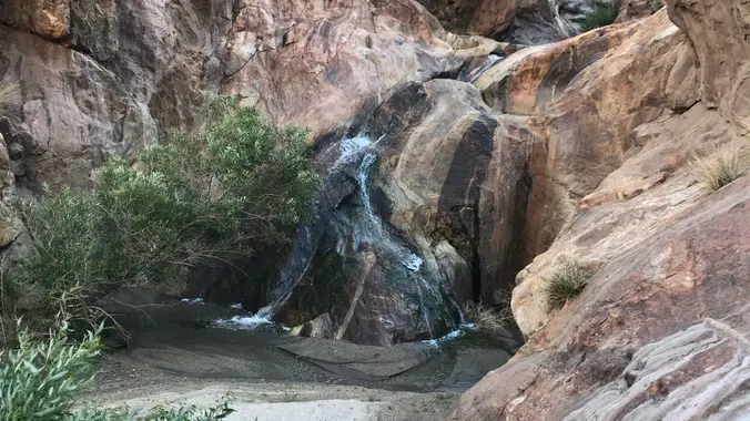
Hike up Coyote Canyon from the road closure, to Sheep Canyon, to Indian Canyon. There is water in Coyote Canyon and Indian Canyon.
GAIA Route
Day 2 (Sunday)
Distance: 7.2mi
Elevation Gain/Loss: 3200’/3400′
Hike up ridge from Indian Canyon to Palm Mesa (sadly no palm trees there). Descend down north fork of Borrego Palm Canyon to the middle fork. There is water in the middle fork and lovely bathtub to soak in.
We may decide to camp a couple miles earlier at the merge of the north and middle fork depending on how people are feeling.
This is a difficult hike. If you’re not up to it there should be no problem to turn back and go back to the first camp. Please do not overexert yourself.
GAIA Route
Day 3 (Monday)
Distance: 4.7mi
Elevation Gain/Loss: 0’/1450′
Descend the rest of Borrego Palm Canyon to the cars.
GAIA Route
DISCLAIMER: Hike at your own risk. Be responsible for yourself and your safety. Make good decisions. With any trip, things can change, reservations can get lost, the unexpected can happen. A go-with-the-flow attitude is always a good thing, and most importantly, let’s all have fun! This is an advanced hike. Make sure you are in good enough physical shape for the distance, elevation changes, and terrain. The hike leaders in this group aren’t professional hike leaders. By signing up for these events, you agree not to hold the Meetup organizers responsible for whatever happens to you on these events. The hiking group does not certify the expertise of the organizers, the event or assistant organizers (hike leaders) and…We are NOT responsible for any possible losses or injuries.


