

At over 100 years old, the Franklin Trail is one of the oldest trails in Carpinteria. It closed back in the 1970s because ranchers worried people could carry avocado root rot to their crops. Through much work among government agencies, the Santa Barbara Land Trust and volunteers, most of the trail has recently re-opened
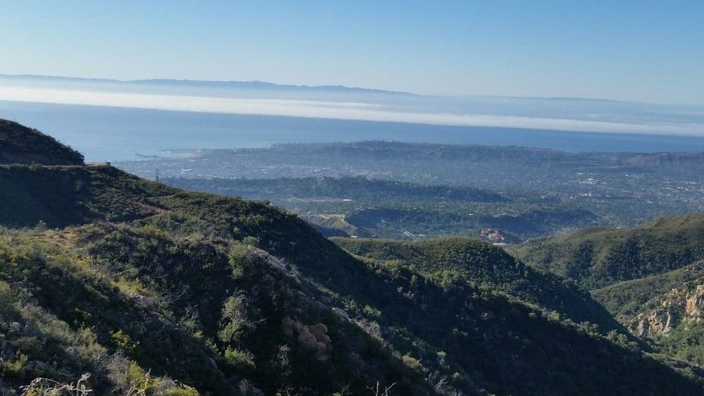
Our hike begins in an urban setting at Carpinteria High School with a steady climb up Franklin Canyon. After a couple miles and 850 ft up we arrive at a prime spot with spectacular vistas of Carpinteria, Santa Barbara, and the Channel Islands. Then its three more miles of hiking fire roads, ranch roads, with the trail moving up-and-down into wild areas and delivering us into the Los Padres National Forest at 1,703 feet. We return the same way we came up. Round trip is about 10 miles with 2,000 ft total ascent.
Here are some photos from the trail. Click on pic to enlarge
[av_gallery ids=’53649,53648,53647,53646,53645,53644,53643,53642,53641,53640,53639,53638,53637,53636,53635,53634′ style=’thumbnails’ preview_size=’portfolio’ crop_big_preview_thumbnail=’avia-gallery-big-crop-thumb’ thumb_size=’square’ columns=’4′ imagelink=’lightbox’ lazyload=’animations_off’ av_uid=’av-2f709y’ custom_class=” admin_preview_bg=”]
Post-hike lunch
Padaro Beach Grill
3765 Santa Claus Lane
Carpinteria, CA 93013
http://padarobeachgrill.com
Click here for directions from trail head

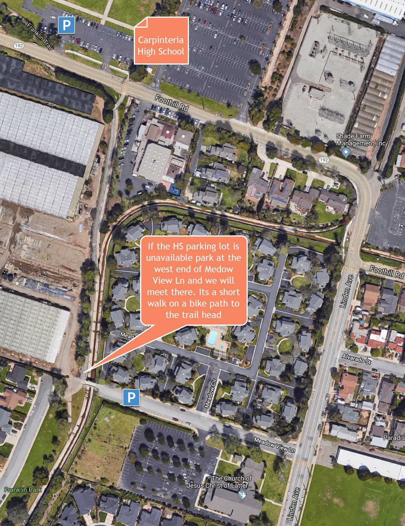
Directions to Trail Head
Drive to Carpinteria High School and park in the west parking lot. Trail head is right there.
[av_notification title=’Alternate Parking’ icon_select=’yes’ icon=’ue826′ font=’entypo-fontello’ color=’orange’ border=’solid’ custom_bg=’#444444′ custom_font=’#ffffff’ size=’large’ close_btn=” cookie_lifetime=’60’ av_uid=’av-lfmxba’ custom_class=” admin_preview_bg=”]
I forgot to call Carpinteria HS to make sure there are no school events Sunday. If there is an event preventing us from using their parking lot, we can use the neighborhood streets. Please review parking “Plan B” below before leaving home.
[/av_notification]


")

")


