

Don’s crazy routes are what VHC is known for. This was one of his favorites and he usually posted it this time of year around his birthday. I can’t think of a better way to remember and honor him than by finally doing the whole route again. Now that we have some water, be prepared to get more than just your feet wet! Rock scrambling water lovers only 🙂
Car shuttle so be sure to arrive on time.
We’re honoring Don and the trails he loved by doing the hikes that he sought out and did so much research on to give everyone such a unique experience. It’s for these experiences that we followed Don, no questions asked. These aren’t the typical ordinary paths that everyone else follows. These are signature Don T. hikes. They’re off the beaten path, exploratory, no name, forgotten trails that few have dared to seek. Some of these trails are more traveled than others but they all have a touch of Don’s adventurous spirit that remains. We can’t ever replace Don but can remember him and his sense of adventure by following his footsteps, just like we always did. This write-up is his:
The Stats
Distance: 5.3 miles
Elevation Gain: 1400 feet
Level: 9 out of 10, scenery factor: priceless
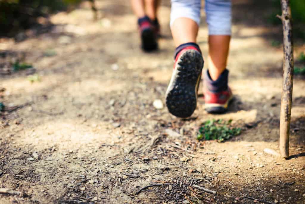
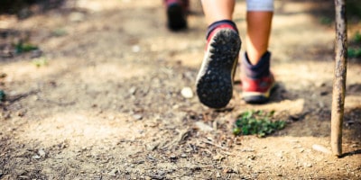
The Trail: Single track, rock & boulder hopping, scrambling, trailblazing and some bushwhacking. PO avoidance.
Time: 5-7 hours (How can only 5 miles take so long? You’ll find out.)

The Plan
Don’t let the mileage fool ya this is a beautiful, very RUGGED and STRENUOUS hike through Lower Zuma Canyon, Upper Zuma Canyon, and Newton Canyon. There is poison oak everywhere in this canyon so you’ll be determining how sensitive you are to it if you don’t already know. I’d definitely recommend a thorough post hike scrubbing with one of the many PO products on the market. This is a car shuttle (one-way) hike where we start the hike near PCH and end up about 4 miles north of PCH on Kanan Dume Rd. It involves some BUSHWHACKING and mostly CLIMBING OVER BOULDERS. Good balance and rock climbing skills are helpful. Also, depending on water flow, you can count on getting your feet wet.
The hike begins around open fields, sycamore trees and laurel sumac bushes. The canyon then narrows and there are oaks and eucalyptus trees along a creek. A good portion of the hike is BOULDERING and some CLIMBING over huge sandstone boulders along Zuma Creek. We’ll stop for a lunch about about 2/3 of the way into our route where Edison Rd intersects Zuma creek. While the trail up to this point will have been a bit of a challenge this is really where the fun starts. Towards the end of the hike, there’s a steep hill to climb (possibly crawl) up.
THIS HIKE TAKES A LOT OF ENERGY!!! (mostly due to climbing up and around the boulders).
Check the Weather (http://www.weather.com/weather/today/Malibu+CA+90265?lswe=90265&from=searchbox_localwx)
Bring Lunch.
Rain does not cancel.

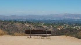
The Area
My recommended Poison Oak remedy. Apply “Ivy Off” before the hike. Have a damp wash cloth with pre applied grease cutting dish soap on it in a zip lock. Wash exposed areas at the last water crossing before climbing out of the canyon. Shower with cold water and more dish soap ASAP.
Directions
We’ll meet at the Backbone Trail Trail Head parking on Kanan Dume.
From PCH: go north on Kanan Dume Rd. Kanan Dume is west of Pepperdine, west of Latigo Canyon Rd, and east of Trancas Canyon Rd. Go about 4.1 miles. It will be on the left just after the first tunnel.
From the 101 (Ventura Freeway): go south on Kanan Dume Rd. Pass Mulholland and Latigo Canyon Rd. On Kanan you’ll go through two tunnels. The trail head will be on the right just before the third tunnel.
From here we will drive to PCH, turn right and take another right on Bansall Dr. Take Bansall to the end to start the hike.
*******************************************************
The Fine Print
PLEASE – Know your limits and abilities. Bring snacks and drink plenty of liquids when hiking. Check weather conditions and dress accordingly and be aware of your surroundings at all times. Watching out for poison oak, snakes, ticks, uneven footing, spectacular views, beautiful fauna all while interacting with awesome (usually) fellow hikers can be extremely hazardous, rewarding and fun.
The Farzan Rule: Posted hike times are the time the hike starts or we leave from a posted shuttle location. I’m aware other Meetup groups offer a grace period for late arrivals; we don’t. It’s your responsibility to know the location of the meeting spot and be there and ready to participate at the posted time. If you have any concerns about the directions feel free to contact the organizer of the event, preferably in advance of the event and not at the start time. I’m of the opinion that it’s not fair to delay an event when the majority of attendees have arrived on-time. (so named after a conversation I had with a certain un-named member)
RSVP’s: If you RSVP for an event be responsible and update your RSVP if your plans change. If your plans change at the last second and you’re not able to update your RSVP also let us know. In my opinion a no-show is someone who has no regard for following the guidelines we request from our members and will risk being removed from future events that have a limit.
VHC HIKE RATING SCALE
Rating a hike is subjective, meaning the difficulty of a hike will be in direct relation to how often you hike and the type of hike you prefer. Keep in mind that any hike can have the following: un-even hiking surfaces, various obstructions, water and/or water crossings or bouldering and/or rock hopping. A great hike will have all of these!
1 – A long walk
2 – 4 mile hike w/little elevation gain
3 – 5 mile hike w/up to 1000 ft. elevation gain
4 – 5+ mile hike w/up to 1500 ft. elevation gain (heart rate increases at times)
5 – 7+ mile hike w/over 1500 ft. elevation gain (heart rate increasing even more at times)
6 – 7+ mile hike w/over 2000 ft. elevation gain (at times you might be trying to remember how to perform CPR)
7 – 5+ mile hike w/over 2000 ft. elevation gain (at times you might be muttering expletives to yourself)
8 – 10+ mile hike w/over 3500 ft. elevation gain (at times you might be angry with the hike leader)
9 – 10+ mile hike w/over 5000 ft. elevation gain (at times you might be thinking of reporting the hike leader to the authorities)
10 – Use your imagination
Class 3 Scrambling: Scrambling or un-roped climbing. You must use your hands at times to hold the terrain or find your route. This may be caused by a combination of boulders, steepness and extreme terrain. Some Class 3 routes have ropes in place for assistance.
DISCLAIMER / RELEASE OF LIABILITY
IMPORTANT, PLEASE READ BELOW IN ITS ENTIRETY:
I am a volunteer (i.e. not liable for the group). Safety is a priority for everyone in the group. Think of this as hiking with a group of friends.
Outdoor sports and other events we plan can be inherently dangerous and accidents may happen. By participating in any posted event, you’re taking responsibility for your own safety and well-being. The Valencia Hiking Crew Meetup Group and its organizers are not trained leaders and we do not confirm the qualifications of any of its members to lead or participate in trips. All participants take full responsibility for their own actions. If you choose to sign up for any Valencia Hiking Crew Meetup events, you are releasing the Valencia Hiking Crew Meetup Group and it’s organizers from all liability in case of possible injuries as stated in paragraph 6.2 of the Meetup “Terms of Service” located on the bottom of the Meetup website. Your personal safety depends on your own judgment and experience.


")
")


