

The Stats
Distance: 14 miles Up and back Elevation Gain/Loss: 4800 ft.
Rating: Moderate to Strenuous 8/10
Trail: Single track, some fire road at the end. Upper 2/3 of the trail is shaded.
Duration: roughly 8 or 9 hours
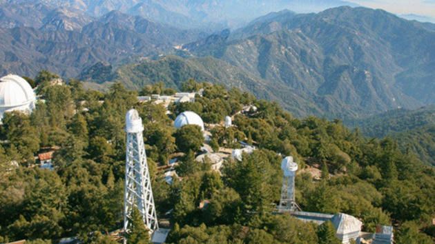
We will stop for lunch at the Cosmic Cafe Pavilion (outdoor seating only) at the summit. Eat theirs or bring your own!
http://www.mtwilson.edu/cafe.php
Trail Description
The Mt. Wilson Trail is a former Gabrielino Indian trail that snaked through breath-taking Little Santa Anita Canyon to the top of Mt. Wilson. White settlers in the area used the trail in the mid to late 19th century for access to the harvesting of pine and spruce higher on the slope of the canyon. Those were the days when California grizzlies were common in the San Gabriels.
This trail is the site of an annual 8.6 mile race from the downtown plaza of Sierra Madre to Orchard Camp and back. This race was first run in 1908 all the way to Mt. Wilson. Its modern incarnation, begun in 1967, is of course much shorter.
Apart from a route from Chantry Flat through Big Santa Anita Canyon , the Mt. Wilson Trail is the most popular route to the top of Mt. Wilson.
The trailhead is at 970 feet elevation.
The Mt. Wilson Trail ascends the western slope of Little Santa Anita Canyon. Be advised that this trail is one of the steeper ones in the San Gabriel mountains. About ½ mile from the start, you will come to a noticeable point where the trail crosses a ridge. The ridge on your right side runs down to the creek.
At 1.2 miles, you will reach First Water Junction, where you go left up the trail.
At about 2.75 miles from the start, you will reach Decker Springs where you will quickly drop into the creek and just as quickly ascend. From here, it is about 1/3 of a mile to Orchard Camp, a nice shady rest spot if you’re so inclined.
From Orchard, it is 1.9 miles to Manzanita Ridge where you will connect with the Winter Creek Trail coming from Chantry Flat. Go left (northwest) and continue to a major junction where the trail meets the Mt. Wilson Toll Road coming up from Altadena through Eaton Canyon. Here, the southeast ridge of Mt. Harvard meets the road and Mt. Harvard is to your left.
At the trail/toll road junction, turn right and proceed up the toll road. When you come to a structure (known as Martin’s Cabin) on the left side of the road, look immediately to your right and you will encounter the resumption of the Mt. Wilson Trail. This point is about a mile distance from the Manzanita Ridge. Proceed up the trail, now single track again, .75 miles to the parking lot summit of Mt. Wilson.
No permits are needed for hiking this trail to Mt. Wilson. Neither is an Adventure Pass required to park at the trailhead because it is not located within the Angeles National Forest.
Directions
The Mt. Wilson Trail trailhead is located within the city limits of Sierra Madre. From the 210 Freeway, exit Baldwin Ave. and go north. When you come to a traffic light where you have to go either right or left, go left to the next light and that is Baldwin Ave. Take a right and continue up Baldwin Ave. through the downtown area of Sierra Madre. Approximately ¾’s of a mile from the downtown plaza, take a right on Mira Monte. Go down about ½ mile and you will come to a small park on your left. Park anywhere in this area long Mira Monte. (Note: it seems that Sierra Madre police are serious about curbing your vehicle’s wheels). To get to the trail, walk up the paved road that heads north off of Mira Monte next to the park. About ¼ of a mile up the paved road, you will come to the signed start of the trail.
VHC HIKE RATING SCALE
Rating a hike is subjective, meaning the difficulty of a hike will be in direct relation to how often you hike and the type of hike you prefer. Keep in mind that any hike can have the following: un-even hiking surfaces, various obstructions, water and/or water crossings or bouldering and/or rock hopping. A great hike will have all of these!
1 – A long walk
2 – 4 mile hike w/little elevation gain
3 – 5 mile hike w/up to1000 ft. elevation gain
4 – 5+ mile hike w/up to1500 ft. elevation gain (heart rate increases at times)
5 – 7+ mile hike w/over 1500 ft. elevation gain (heart rate increasing even more at times)
6 – 7+ mile hike w/over 2000 ft. elevation gain (at times you might be trying to remember how to perform CPR)
7 – 5+ mile hike w/over 2000 ft. elevation gain (at times you might be muttering expletives to yourself)
8 – 10+ mile hike w/over 3500 ft. elevation gain (at times you might be angry with the hike leader)
9 – 10+ mile hike w/over 5000 ft. elevation gain (at times you might be thinking of reporting the hike leader to the authorities)
10 – Use your imagination
Class 3 Scrambling: Scrambling or un-roped climbing. You must use your hands at times to hold the terrain or find your route. This may be caused by a combination of boulders, steepness and extreme terrain. Some Class 3 routes have ropes in place for assistance.
DISCLAIMER / RELEASE OF LIABILITY
IMPORTANT, PLEASE READ BELOW IN ITS ENTIRETY:
I am a volunteer (i.e. not liable for the group). Safety is a priority for everyone in the group. Think of this as hiking with a group of friends.
Outdoor sports and other events we plan can be inherently dangerous and accidents may happen. By participating in any posted event, you’re taking responsibility for your own safety and well-being. The Valencia Hiking Crew Meetup Group and its organizers are not trained leaders and we do not confirm the qualifications of any of its members to lead or participate in trips. All participants take full responsibility for their own actions. If you choose to sign up for any Valencia Hiking Crew Meetup events, you are releasing the Valencia Hiking Crew Meetup Group and it’s organizers from all liability in case of possible injuries. Your personal safety depends on your own judgment and experience.
CONTACT ME WITH ANY QUESTIONS!


")


